Sunday, June 9, 2013

Day 3: Casper to Buffalo, Wyoming

A Day of Champions, Massacres, and Massacred Music 


Not only are the Wyomingites friendly and courteous, but there aren't too damned many of them, either.  The population is just the way I like it:  close to 1.5 million cattle, and under 600,000 people.  That means miles of ranch land, places where you can still hear your own footsteps, air that's worth breathing.

Twenty-six miles south of Kaycee, we pass through serene, gently sloping hillsides populated by antelope and livestock.  I don't bother taking too many photos of antelope; they're like our own cottontail rabbits, always a joy to see but so prevalent that you just don't think of grabbing the camera every time you pass a congregation.  This land is so quiet and tranquil it's hard to imagine the violence that swept it during the range wars of the late 1800's.  This is Johnson County:  site of one of the most ruthless, brutal and downright dirty range wars.  Powerful cattlemen, in a horrendous turn of events, hired assassins such as Tom Horn and Frank Canton to come in and exterminate the homesteaders, whom they designated with great recklessness as "rustlers."  That topic, of course, is be food for a future article; even today, the details are heartbreaking and frightening.  This west wasn't just cowboys-and-Indians friction:  it was cowboys versus cattlemen, Mormons versus Gentiles, foreign interests versus local homesteaders, the powerful against the oppressed.

We pass through the area where John Tisdale, one of the early casualties of the Johnson Country troubles, was ambushed.  Tisdale was assassinated in Haywood's Gulch on his way home to his family after buying winter supplies in Buffalo.  The suspected killer was Frank Canton.  Roadside monuments mark the site of the TA Ranch and the Tisdale Ranch.

Before reaching Kaycee, we cross the leisurely trickle of water called the Powder River.  This land -- the Powder River Country -- was the hunting grounds of the Plains Indians -- Sioux, Cheyenne, Arapaho.  Although the once-abundant buffalo are gone, we see an impressive amount of small, fat deer, untroubled by our presence.  The Powder River country is also the chosen land of one of my favorite country singers, the late, great bareback rider Chris LeDoux.  I'm eager to see Kaycee, where he bought his ranch and raised his family.  He loved the land enough to stay there rather than live the Hollywood or Nashville lifestyle that most certainly beckoned him, and some of his lesser-known songs are ballads of the Johnson County War, and tributes to his "Powder River Home."

Copyright (c) 2013 by MJ Miller
Chris LeDoux's Memorial Park
Chris was the real thing.  A bareback champion by the time he was 16, Chris rodeoed successfully for years before turning his focus to singing his ever-upbeat, joyful songs of rodeo and western life.  In the center of Kaycee is a fittingly beautiful tribute to such a man:  a quiet small-town park shaded by flowering trees, a small rock waterfall, flower-lined paths, and a greater-than-lifesize bronze sculpture.  Titled "Against These Western Skies," it depicts Chris riding the bucking horse, Stormy Weather, to the championship -- set on a guitar-shaped base.  Naturally, there's a huge, life-loving grin on LeDoux's face in the sculpture.


Copyright (c) 2013 by MJ Miller
Cattle Grazing Near Hole in the Wall

Copyright (c) 2013 by MJ Miller
Red Bluffs Near Hole in the Wall, Wyoming
It's a stunning drive through miles of stunning ranch land to the Hole in the Wall area of Bighorn Basin.  Although the road covering the last five or six miles to the outlaw cave that sheltered Butch Cassidy and his confederates is inaccessible to the public, it was evident that they had loped past the same red bluffs we admired.  Buttes such as those shown here provided an advantage for the gang to ambush any pursuers. This is outlaw country, frequented by robbers and hired guns -- and the bodies of those they slaughtered.


Nate Champion, one of the early victims of the Johnson County War, was murdered in a barn between Kaycee and Buffalo, where he bravely holed up against the "Invaders" -- Texans brought in by the all-powerful Wyoming Stock Growers' Association to kill off anyone even remotely allied with the rustlers.  Nate, during his hours fending off his attackers in the KC ranch cabin, kept a journal of his final moments.  Nate's notebook, unlike himself, survived as the Invaders set fire to the cabin, gunning Nate down as he fled the flames.


Copyright (c) 2013 by MJ Miller
As we drive, we happen across the quiet Willow Grove Cemetery in Buffalo.  We stop to walk around. No one else is within sight; we have the acres of marble monuments to ourselves.  There are no tourist-oriented signs announcing the famous (or infamous) grave sites here.  I flip through an alphabetical list of those interred, and to my surprise I find Nate Champion.  The courageous man lies beside the grave of his brother, Dudley.  Nate died a horrid death -- but his place of repose is serene.  Nearby, the Tisdale family plot is shaded by massive trees.


Copyright (c) 2013 by MJ Miller
Fort Phil Kearny
We soon venture to Fort Phil Kearny, from which the soldiers who fought in the Fetterman Massacre and the Wagon Box Battle were deployed.  At the interpretive center, the gregarious woman who greets us asks where we're staying.  When we tell her we'll be at the Occidental Hotel in Buffalo, she warns us not to talk to the pig-tailed woman there.  "If you talk to her, before the night is through she'll be asking you for money!" she cautions us.  She gives us a nutshell narration of the events of the battles, and we tour the place where the fort had stood.  No traces remain; after it had been rendered inactive, it was burned to the ground by the Indians.  Not it is but a vast grassy expanse, dotted with brass placards and site markers where corner-posts had been.  Here, Carrington's troops lived, trained, and fought hard, and too many met an early grave.  The countryside is vibrant green, the fort nestling in a valley surrounded by hills and peaks, watered by a stream.


Copyright (c) 2013 by MJ Miller
A Very Chilled Me on The Bozeman Trail at the Site of the Fetterman Massacre


Copyright (c) 2013 by MJ Miller
An Old Wyoming Sign Used as a Foot-Bridge Over a Gully


Copyright (c) 2013 by MJ Miller
Sweeping View from the Site of the Fetterman Massacre
Capt. William J. Fetterman led 80 men to their death while attempting to aide an embattled wagon train on the Bozeman Trail; three were later killed in the battle at Wagon Box.  We walk all the sites, just miles apart.  Wagon Box overlooks a stunning vista, while the Fetterman Massacre site is on a ridge with sublime hills, valleys, and views of the Bighorn Mountains.  It is almost surreally beautiful.  We walk the path the troops had taken in both pursuit and retreat during the battle.  Rain drops on us and the wind kicks up; I am shivering wind-whipped, and my teeth are chattering.  Daunted, we sit in the Jeep for a few minutes deciding whether or not to venture out -- but having come so far, who would pass the chance to walk on actual remnants of the bloody Bozeman Trail?  It is a walk of maybe two miles, with markers indicating where the key points of the massacre had occurred.  The rain makes the scene more poignant.
Copyright (c) 2013 by MJ Miller
A Pair of Herons at the Site of the Fetterman Massacre


Abruptly the wind stops, the clouds part, and we're treated to the most seductively lovely sunny afternoon, there on that bloody ridge overlooking indescribably beautiful hillsides.  A pair of herons makes an odd chuckling noise nearby, too shy to be properly photographed.

Copyright (c) 2013 by MJ Miller
Site of the Fetterman Massacre
Copyright (c) 2013 by MJ Miller
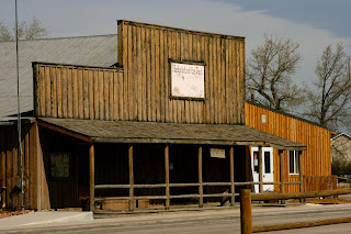
The Occidental Hotel, Buffalo, Wyoming
We are warm by the time we return to Buffalo.  As we unload the Jeep on the roadside, the woman from the fort happened buy in her blue pick-up and yelled out the window, "Remember, don't talk to the woman in the pigtails!"  As we approach the hotel, lugging our clothes, an odd woman resembling Liz Taylor is seated at a sidewalk table; she gives me a cold, venomous stare as we walk by.  The woman in pigtails greets us at the front desk and gives me a quick synopsis of the effort that went into renovating the hotel.  She is the owner.  She tells us we're in luck tonight:  there's a bluegrass jam in the hotel's saloon, and the state's PBS is there filming it.  It fills up fast, she warns -- so get there early; she'll reserve seats for us.

Attentively renovated to resemble its original western appearance, the Occidental boasts not only that Butch Cassidy slept there, but that Owen Wister's Virginian ultimately got his man there.  The restaurant attached to the hotel is called the Virginian, appropriately.  We pass it up over Russ' shock at the prices on the menu, and instead stop at Up in Smoke, a barbecue joint up the street.  There, a sweet and perky waitress serves us the most expensive (and least worthy)  BBQ we've ever eaten. We each have a beer and a sandwich and a small dish of ice cream, and I can't help but laugh at the $50 tab.  It's just plain funny that it nearly costs as much as the upper-crust fare at the Virginian may have.

Copyright (c) 2013 by MJ Miller
Lobby of the Historic Occidental Hotel, Buffalo, WY
The pigtailed woman is right: the saloon is filled with eager locals, including the Liz Taylor clone, for the bluegrass jam.  The voices aren't great, but the crowd spirit is enviable.  During a particularly painful yodeling session, Russ smiles and says, "There IS something worse than bagpipes!"   We retire early, making our way up the creaky stairs to our "Rose Room." Russ glances around and comments, "It's like being at my grandmother's."  He's right:  there are cabbage rose patterns, brocades, quilts, gilt frames, and porcelain ... everywhere.  The room, as the proprietress had informed me, was once two brothel rooms, which did not have bathrooms; she had done significant remodeling to provide each room with a bathroom.  The main room is spacious, but the bathroom cramped and bath-tub free.  There's not quite enough room in the shower stall to shave a leg.  We don't mind; we're happy enough to be in a hotel that has the same feel it likely did when dusty travelers passed through over a hundred years ago, in the company of the ghosts of frontier whores and horse thieves.

It has been an easy day for driving; 240 miles, and every inch boasting gorgeous scenery.


Monday, June 3, 2013

Day 2: From Rifle, Colorado to Casper, Wyoming

Copyright (c) 2013 by MJ Miller


Fields of lush green grass filled with herds of Angus cattle, horses, and sheep mark our morning drive out of Rifle.  It's calving and lambing season still, and dozens of youngsters recline in the mild morning sun.  We are headed to Glenwood Springs, where Doc Holliday issued his last consumptive breath.  The Colorado River parallels the freeway through gorgeous gorges, accompanied by train tracks.  We are treated to a fly-by -- the first of many -- of Canadian geese.  Suddenly, a view of the snow-covered Rockies erupts through these gentler, greener slopes.  For a moment this stunning beauty makes me wonder why not everyone lives here; then, we find ourselves on Grand Avenue during Glenwood's morning rush, and I think, everyone does.

It is not a bad rush hour, to be fair; it's your typical small old-west town with narrow streets confined by historical buildings, and city planners who rightfully decide not to remove the old beauties to make more room for the sight-seers visiting in order to enjoy them.  Thank heavens many of the historical sights have been preserved and cherished.  We enjoy a quick stroll through town before breakfast, briefly stopping to read the historical plaque marking Doc Holliday's death site.  Once called the Glenwood Springs Hotel, Doc died alone and destitute in his room within.  Local gamblers and whores took up a collection to defray some of the costs of his burial; the county incurred the rest.

Copyright (c) 2013 by MJ Miller
A Glenwood Springs Street Scene

The Glenwood Springs Hotel later burned to the ground, like so many of the gems of our old west history; that's why I did not photograph the site.  When making a destination of historical sites -- particularly such frontier buildings -- it's a good idea to do a little research first to ensure you'll be seeing the actual building, if that matters to you.  It is too often a recurring theme as you visit:  "The original structure burned to the ground, but was later rebuilt."  I favor the originals; re-creations and estimations don't do much for me on a visceral level.

The cemetery where Doc is buried is at top of a nearby hill.  The outgoing woman in the visitor's center says, "even we old folks can make the climb."  It is my 50th birthday vacation:  what is she trying to tell me?  Is she in cahoots with those AARP folks, who sent me my first membership card two days before we embarked?

We meander through the cemetery, Linwood Springs, which I am able to get to -- during the climb, I blame my shortness of breathon the altitude.  In addition to Doc's monument, we also visit Kid Curry's -- perhaps.  I will leave the details on the resting place of Doc and Kid Curry to an upcoming post; it's an interesting subject in its own right, and deserves special mention.

In the mountains that surround the town, paragliders ride the thermals above the greenery.  Just north, tourists ride the tramway to the mountaintop.  There is much to do in this pretty town.

We hit the road instead.  State highway 13, Meeker-bound, to be exact -- edged by expanses of livestock-dotted pasture.  We pass miles of picturesque ranches sporting log cabins and tumbledown barns and gathering pens with rustic cattle chutes.  The cattle are fat and happy, the scenes idyllic.  The Meeker area is famed for its hunting opportunities and deer and elk are in abundance.  We see many of the slower ones on the sides of the road, the victims of the inevitable collision with humankind.


Meeker is charming.  Dandelion-carpeted fields grazed by an assortment of cattle -- white-faced, black Angus, even Scottish Highland cattle with their distinctive shaggy fur.  Cattle trucks are all stopped in a line for inspection; we are in cattle country beyond a doubt.

As we enter Moffatt County, we enjoy beautiful rainfalls.  Narrow streams thread their way through neon-green fields, edged by cattails.  By the time we reach Hamilton, the streams are wider, more assertive, and have carved deep, steeply-banked serpentine channels.


Copyright (c) 2013 by MJ Miller
Craig, Colorado


The town of Craig was a surprise:  a welcoming, pleasant cow town, and one I had heard little about - not enough to have an image in my head or any set expectations.  Among the humble older homes downtown are some astonishing examples of immaculately-preserved Victorian homes.  The gem of our visit, though, was the Northwestern Colorado Cowboy and Gunfighter Museum.  That, too, will merit separate mention in a future post.  It was a gem of a place with a worthy collection, and well-displayed to boot.

I tend to avoid tourist-type shopping when I travel.  I prefer to pick up functional things along the way rather than traditional souvenirs; perhaps a ball-cap I can wear for the remainder of the trip, or a sweatshirt.  It was in Craig that I realized Russ was planning to take my thin-blooded Arizona desert-rat self through Bear Tooth Pass on the way down from Montana.  It was in Craig that he told me that there would be snow and it would be in the 20's when we got there.  It was in the hundred-degree weather of Arizona two days before that my beloved had assured me I would not need a jacket, and that he was not taking one.  It was in Craig that he admitted that he had, in fact, packed one.  Thus, it was in Craig that I found a wonderful ranch-supply store -- the best kind, the ones that carry Carhartt products -- and guilted Russ into buying me a wonderful Carhartt jacket.

Authentic ranch supply stores are things of beauty.  You can buy livestock feed, shooting supplies, tractor parts, and socks.  There are clothes -- useful clothes -- and tack and dog toys.  Thankfully, we were in the Jeep.  I could have loaded up.  Murdoch's Ranch and Homes Supply, count me as a fan.  

From Craig to Baggs, we've just passed bunny hills dotted with countless white boulders ... boulders that, as we approach, sprout legs and newly-shorn wool.  Sheep, sheep everywhere -- blending in as sheep do.  In great contrast is the  herd of draft horses not far past them -- an impressive gang of flaxen-maned beauties and their solid-black counterparts, their legs feathers so full we see them from the highway.  They stand on a mound in all their grandeur, self-segregated from the light horse in a cluster nearby.

Then, the rain.  Big plashy drops smacking the windshield, temperature dropping from 74 to 60 in a moment's span.  With more dark clouds ahead, and me in my new Carhartt, we enter Wyoming.

Copyright (c) 2013 by MJ Miller
You can see from the muted tones of the "welcome" sign that it is a gloomy, blustery day in May.

Copyright (c) 2013 by MJ Miller
You can tell from the snow on the peaks ahead of us that I am thankful to have a new jacket.

Copyright (c) 2013 by MJ Miller
Southern Wyoming is antelope and brown hills.  It is pouring by the time we reach Rawlins.  Here we admire the forbidding sandstone facade of the old Wyoming State penitentiary.  Here, Butch Cassidy served time when arrested for buying a stolen horse.  On its grounds is a small, austere cemetery.  Across the street is a more appealing plot of well-marked graves, a deer placidly graving on one of them.

Copyright (c) 2013 by MJ Miller
Wyoming State Penitentiary


The rain continues with a determined constancy.  It's puzzling to see so much rainfall on such a brown land.  It's 51 degrees.  I am surprised, coming from Arizona, that it is 51 degrees anywhere in May.  We pass a sign marking the Sand Creek Massacre Trail.  The trail follows the path the Arapaho and Cheyenne took after the horrific travesty known now as the Sand Creek Massacre.  It was a dark moment in American history when U.S. troops, led by the brutal, Indian-hating Colonel Chivington, slaughtered the men, women, and children in a Cheyenne village headed by Black Kettle and -- poignantly -- flying the American flag.  The actual massacre site is in Colorado; the lengthy trail is run today by Arapaho youths who view the experience as catharsis.

Somewhere, amid the endless miles of drab scenery long before Casper, with rain blown against us on a quiet stretch of road, Russ manages to attract the attention of a state trooper.  Russ, ever the conservative driver (meaning that he drives far more slowly than I do), comments on how strong the tailwind is because the Jeep -- which is anything but a speed demon -- was finding it easier to pick up speed.  Not minutes later, the overheads and wigwags of a patrol vehicle light up ahead.  Having realized just the night before when we tried to check in at the motel that Russ had left his license at a recent doctor's appointment, he tells the trooper, "I don't have my license."  The officer drily replies, "Perfect."  It is so windy the deputy can't keep his Smokey hat on; he returns with the citation, saying, "It's cold, I'm freezing, here's your ticket."  

We make it to Casper without further felony, and struggle to find an appropriate motel.  As luck would have it, sleepy Casper is hosting the play-offs for a high-school athletic event.  We eventually land at the La Quinta.  We walk across the North Platte River, where Hispanic fishermen have their fishing poles dropped into the water from the banks, to a local steak-house for dinner.  It is chilly ... I'm glad to have that jacket.


Day's stats:  398 miles, and one ticket for 78 in a 65 zone.


Saturday, June 1, 2013

Road Trip Day 1: Welcome to Utah

Copyright (c) 2013 MJ Miller

One of the great advantages to a road trip rather than destination-style travel is the emphasis on the path rather than just the end-point. Instead of a goal-orientation, there's a pleasure in the process that stays with you throughout the entire trip. To enhance that, we tried to avoid freeways as much as possible while still recognizing the limitations of eight days' time. We also adopted a leisurely pace, for the most part -- and that meant stopping at roadside monuments, visiting places not on our already-flexible itinerary, and pulling over frequently to take photographs. 

It wasn't until we'd reached Monument Valley that my camera began to live on my lap, and from that point forward, I juggled three cameras -- my beloved Canon Rebel, my smaller Canon Powershot, and the camera built into my iPad. Having just received my new iPad as a birthday gift, I was constantly aware of the risk I was taking while waving it out the window to snap a shot while in motion -- let's just say it's not streamlined, and I had visions of it taking flight. I'm glad I experimented with it rather than sticking to my trusty Rebel. The iPad delivered some unique photographs reminiscent of muted water colors, while others were so vibrant as to seem more like pop art. 

Copyright (c) 2013 MJ Miller

Russ was quite patient in my demands to stop, make U-turns, and otherwise indulge my need to take the same shot with three different devices. In many ways, I've been bad for Russ: for one, I don't think the man really learned to swear until hanging around me. On the bright side, when he does swear, it's often to great comic effect. I can't print a lot of his Russisms, but I'll share what I can.  He started off our sight-seeing with a remark that was dead-on: as we entered San Juan County, Utah, with the surreally beautiful rock formations dotting the desert, Russ gazed at the landscape and said, "It's going to be a great vacation. Look at all this shit."

 At a gas stop on the reservation, I talk briefly with a woman walking a wet border collie. She tells me, "She just got to swim in the San Juan River!" A few minutes later, we cross the river ourselves. I pay it little attention; I don't yet realize that we'll be in the company of so many great rivers on this trip, and I neglect to take its picture for the sake of future comparison.  Rivers, to we who were born in the desert, are impressive things.


Copyright (c) 2013 MJ Miller
Here's an early indicator of the texture of our trip -- multi-colored strata of weather-beaten hills.

Copyright (c) 2013 MJ Miller

This is, I think, one of the most-photographed of rock formations in the state.  I had to do my part.


Copyright (c) 2013 MJ Miller

Before too long, I was rock paparazzo.  I stalked rocks and photographed them.  These particular formations, being so near to a heavily-traveled highway, are something of the Lindsay Lohans of the rock formation world -- instantly recognizable and endlessly photographed -- but they're not quite as hard looking, and they've aged much better.

We stop for "dunch" in Monticello -- a late lunch, early dinner meal at a log-cabin restaurant called the MD Cowboy Cafe.  The sweet, Cleopatra-eyed waitress brings Russ his burger, bud with the verboten cheese on top.  Heaven forbid Russ should eat cheese.  The waitress is ever-apologetic, but Russ nonchalantly peels the cheese off like so much Velcro and tells her, "This is not my first cheese rodeo."  The town itself is quaint four-square houses and green fields with a smattering of glossy, well-pastured livestock.  It's unassuming and tidy and has a comfy, homey feel.


Copyright (c) 2013 MJ Miller

We pass "Hole in the Rock."  Russ, always the eloquent admirer of the picturesque and the kitschy, says, "I was in there one time.  It's just a cave and a gift store."  The photo above is as close as I got.  The photo below is a much more authentic hole in the rock.
 
Copyright (c) 2013 MJ Miller

And then we pass hours in which I couldn't so much as type a word in my travel notes ... because we're driving on Highway 128, on the west edge of Arches National Park.  The photographs can't hope to capture the beauty of it.  To the east, the La Sal mountains peek through, snowy and alpine; in the foreground, brick red and magenta cliffs.  To the west runs the Colorado River, pristine beauty broken only by the occasional rafter and kayaker.

Copyright (c) 2013 MJ  Miller

This isn't our first sight of snow for the day, but it is the grandest.


Copyright (c) 2013 MJ Miller

This is the point where I should just shut up and let the pictures speak for themselves ...


Copyright (c) 2013 MJ Miller

... but I just can't do it.


Copyright (c) 2013 MJ Miller

Although it's hard to wrangle the 1,400 photos I took on this trip, I can at least say with confidence these were all taken on the same afternoon.  I was understandably giddy with the varying colors and intensities.  Seeing these landscapes and knowing how pathetic I am at painting is a special sort of humiliation -- they beg to be painted, but competently.


Copyright (c) 2013 MJ Miller


Above is an example of an iPad photograph.  The iPad did the painting for me on this one, interpreting the mountains as some sort of day-glo poster.

Copyright (c) 2013 MJ Miller

The typical view was more calming on the eyes ... warm plateaus, green and yellow brush, and those stunning snowy peaks against a desert sky.

Eventually, we break through the north end of the canyon.  Red cliffs fade away into green bunny hills.  They look like something from a children's picture book, gentle and beckoning.  We soon enter Colorado. 


Our day ends in Rifle, Colorado:  598 miles and a thousand bugs on the front grill later.


Sunday, May 26, 2013

In Pursuit of the Great Western Road Trip

For me, the words "road trip" evoke visions of sweeping vistas, vast horizons, miles of undeveloped lands and open roads with only occasional interruption by fellow travelers.  There is arguably no better place for such a journey than our American west.  I'm biased, I know, and I'm good with that:  in this vanilla society, where it seems in vogue to apologize for one's opinion and convictions, I'm perfectly happy to assert that I love the west and that other places pale in comparison.  I love long drives and little traffic.  I love small towns and roadside history and a good cup of coffee in a chipped stoneware cup at a rural diner.  I love being out of range of cell phones and email and the long leash of electronic communications.

It's only appropriate that the first vacation I've had in a couple of years (although some might argue that I'm enjoying a life of permanent vacation, and in all honesty, they might be right) was a road trip through my beloved west.  We ventured north from our home state that borders Mexico, going as far north as Montana -- which borders Canada.  Our jaunt encompassed eight days, six states, 2,800 miles, 1,400 photos, six national parks, eight museums, five battlefields, four burial grounds, one leather show and so many historically-significant rivers and vast national forests that I couldn't keep count.  It wasn't the race it might sound like from those stats:  we didn't do the stereotypical "American tourist" interstate approach ("Okay, honey, you enjoy the left side, I'll enjoy the right.")  Instead, we walked the battlefield trails.  We meandered through cemeteries, pondering weather-worn tombstones.  We spent joyful hours studying the firearms and saddles in museums, hopping in and out of the Jeep to take photos or read historical markers, and off-roading in search of outlaw hangouts.  We listened to some at-times-painful bluegrass music in Buffalo, caught up with friends at the regional leather show in Sheridan, and threw snowballs in Yellowstone.

Along the way, we enjoyed serendipitous finds:  the graves of pivotal figures of the Johnson County War in Buffalo, Wyoming; a dazzlingly extensive collection of western relics in the Don King Museum in Sheridan; a rain-spattered view of the Wyoming state penitentiary, where Butch Cassidy served time for buying a stolen horse; and spent some time in reverence of the man and his music at the Chris LeDoux memorial park in Kaycee.  Most of all, we were stunned by that great western landscape that never fails to make my heart ache with sheer awe.

I originally planned to write the journey as we traveled.  I figured I'd spend some quality time with my iPad every night in the silence of a cheap motel room, tapping out the day's adventures.  Technological issues and a saturated brain interfered with my good intentions; connectivity was iffy much of the time, and I soon realized I would need to approach the juncture of place and history at a more moderate speed.  Each place, each history, spawned more mystery.  I needed to do more research to fully grasp the sites and sagas we encountered.  Late sunsets meant plenty of time to drive further, walk later, and cover more ground.  We were unhurried but busy -- the key to happiness.

So here it begins:  in weeks to come, I'll be sharing not only our brief travels, but the historical footnotes of the areas we visited, in that order.  I hope you'll come along.


The road ahead beckons!  Above:  Monument Valley.

Sunday, April 28, 2013

Billy the Kid's Escape: 132 Years Later

April 28th, 2013.  It was on a Thursday, 132 years ago today that the outlaw, Billy the Kid, gunned down two Lincoln County deputies and escaped from his quarters in the Lincoln County Courthouse.  One-hundred and thirty-two years ago, and still Billy's legend lives on -- six times as long as Billy's own life span.

I have a special interest in Billy's last days.  It was on a 150-mile trail ride, just a few years ago, that I met my future husband.  It was he, a new acquaintance at the time, who gave me my first tour of that very Lincoln County Courthouse, and walked me through the stairway in which Billy killed Deputy Sheriff John W. Bell.  We had ridden from Fort Sumner to Lincoln, New Mexico, across the same ranch lands that Billy had ridden and fled through, and watched the same sunrises on horseback that Billy had watched.  For the record, we did the ride in sort of reverse:  Billy murdered Deputy Bell and Deputy Bob Olinger in Lincoln, and was himself killed in Fort Sumner, not quite three months later.  Our ride was but a week long, and didn't end in gunfire.

Accounts of Billy's initial escape vary, as "first-hand" accounts often do.  I know from two decades of police work that if you ask five eyewitnesses to recount an incident, you get seven different accounts.  Emotion, involvement, lighting, stress, and the usual human motives influence the accounts; none of us truly see factually, truth be told.  Frederick Nolan's excellent work, "The West of Billy the Kid," gives several versions within the same work:  he cites Billy's own side of the story as told to J.P. Meadows, as well as a contemporary account from the Las Vegas Gazette (Las Vegas, New Mexico, that is) of May 10, 1881, and additional theories advanced in retrospect.  He correctly points out that no one knows the truth.

The facts as they are known are these:  Billy was being held in anticipation of his scheduled execution date, planned for May 13, 1881.  His guards, Deputy Sheriffs J. W. Bell and Bob Olinger, were responsible for tending him in his room on the courthouse's second floor.  On the evening of April 28th, Bob Olinger took Billy's fellow prisoners across the street for their meal at the Wortley Hotel, and Bell remained behind to guard Billy.

At some point, Billy used a revolver of uncertain origin to kill Bell, who made it outside the courthouse before dying in the company of Godfrey Gauss.  Gauss alerted Olinger, who returned to the scene where Billy waited, armed with Olinger's own shotgun.  Billy shot Olinger with both barrels, and Olinger died immediately.  Billy then left town, and remained at large until July 14, 1881, when he was shot by Sheriff Pat Garrett at Pete Maxwell's house in Fort Sumner.

The details regarding the escape, though, are wiggly.  How Billy managed to get the jump on the experienced officer, Bell; how he obtained the pistol; and his words as he watched Olinger die are all subject to years of debate and interpretation.  Some say that Billy yelled at Olinger, "You won't follow me any more with that gun," as he died, and others say that Billy shouted, "You damned sonofabitch!  You won't corral me with that again!"  No one is ever going to know for sure, but the lines are certain to continue to change with the retelling.

It surprises me to read the various accounts and see the righteous indignation of many of the Billy historians who apply their own interpretations to the events.  Nolan, for example, expresses skepticism that Olinger, upon hearing the shots from the courthouse, would have immediately concluded (as some accounts maintain) that Billy had attempted to escape and Bell had shot him.  Nolan states that it's "hard to understand" such a response.  For my part, it makes perfect sense:  why would Olinger think otherwise?  Why wouldn't he assume that his trusted, experienced colleague, who was armed while Billy was not, had shot the criminal as he tried to escape?

Historians, amateur and otherwise, have dissected the events of Billy's life -- particularly that evening, and the night that Billy was killed -- from their own armchairs for most of 132 years now.  Although the accounts vary widely, one thing seems constant:  they speak with great certainty and confidence that their interpretation is correct.  They take ownership of the events, and are astonished that others don't see them the same way.

It is only natural that we foist our own experiences, personality traits, and values on historical figures.  If we are cowardly, we believe those we are reading about act from a position of fear.  If we are compassionate, we're sure Billy felt badly at killing Bell; and if we've ever been bullied, we're just as sure Billy felt vindicated at murdering Olinger, who had apparently taunted him and treated him with contempt.  It doesn't change the facts, though.  Nolan suggests (by way of a rhetorical question) that Olinger is vexed at not having shot Billy himself.  Those types of innuendo taint our understanding of the actual incident as it played out, just as asking someone, "Are you still beating your wife, Mr. Smith?" immediately implies that Smith has, in fact, beaten his wife.

Be cautious in your reading, and critical in your assessment of historical events.  Writers, like the irascible fellow downing a beer at the local saloon, don't like to let facts get in the way of a good story; and historians, like the typical court-room attorney, are going to confidently and unwaveringly tell the facts as they see them.

The problem is:  who among us has truly seen what occurred, and if we did -- through what filmy vision, influenced by what factors in our own life?

Thursday, February 21, 2013

The State of Deseret: A Historical Footnote


In recently revisiting the textbook used in my high-school Arizona history class, I was surprised to see no mention of the once-proposed "State of Deseret," that would have bound much of the southwestern United States together into a vast Mormon state.  The influence of the Mormon church and its people is widely covered in most Arizona historical texts, but rarely is the planned State of Deseret cited.  Instead, ink has largely been reserved for the role of the Mormons in settling communities across the west -- and, in some chronicles, for the tragic event known as the Mountain Meadows Massacre.  The 1849 proposal by the Mormon church is, nonetheless, quite an interesting bit of trivia despite being relegated to the more obscure annals of history.

The name "Deseret" comes from the word for "honeybee" in the Book of Mormon. The bee is a symbol of industry inspired by the constant work and production level of that busy creature.  You'll often see the word "Deseret" and images of bee hives associated with the Church of Latter-Day Saints.

Known for their own industrious colonization, the Mormon pioneers had only left Illinois in 1847 on their westward trek.  It was less than two years later that the church drafted the "Provisional Government of the State of Deseret."  Most people can barely plan a wedding in so short a time!  Yet the busy Mormons had already made plans for a Mormon-controlled state covering nearly all of the region that is called the "Great Basin" as well as a tract of land that carried the proposed state all the way to the coast.  This chunk of desirable, but arid, real estate extended from mid-Wyoming and southern Idaho down to the Mexican border (this was pre-Gadsden purchase, mind you) and included a significant stretch of California coastline, all of Utah, Arizona and Nevada, and a great deal of western New Mexico and Colorado.

This bold proposal didn't impress Congress, but in a compromise intended to settle the ongoing Mormon conflict, the Utah Territory was created in 1850 to include Utah, Nevada, and significant portions of Wyoming and Colorado.  To the dismay of Brigham Young and the Mormons, the territory did not have the political sway that statehood would have offered.  To placate them, Brigham Young was named the territorial governor.  Young himself would not be so easily bought:  he began to visualize a Mormon nation, rather than just a Mormon state.

As these political and geographical boundaries were defined, the 10,000 or so Mormons in the Great Basin immediately began to work in over-drive to colonize the region.  These colonies were placed in important locations so as to exert control over key locations along roads, trails, and rivers.  Mormons continued to call their much-coveted region "Deseret."  In late 1856, church leaders again considered petition for statehood.  Due to the animosity they received from Congress and the rest of the country as a result of constant conflict (much of it bloody) in Utah Territory, the petition ended up being dropped.

Despite the Utah territorial supreme court's 1856 ruling that common law, based on the English system, was the law of the land, Governor Young's leadership supported the law of the church -- which  included polygamy, blood atonement, the Law of Consecration, and the practice of "lying for the lord."

In early 1857, the conflicts between the Mormon leadership and the federal officials in the territory were so severe that all the federal officers pulled completely out of the land, fearing for their safety.  The federal government, tiring of the subversive activities of the church, began to prepare a military response while Brigham Young planned a militia to counter the federal defense.  By July, President James Buchanan had selected a replacement for the troublesome governor Young.  In preparation he sent 2,500 troops to the contentious territory, along with the well-wishes of much of the rest of the nation.

Within days of the issuance of the troops, Brigham Young convened a great assembly in Big Cottonwood Canyon.  He announced to his followers that they were henceforth no longer part of Utah Territory, but were now an independent Mormon state of Deseret -- and that they must tolerate no further oppression or abuse by the United States.  In August, Young proclaimed that he would in no way allow U.S. soldiers to reach Salt Lake, and further prepared his people for war.

On September 11, 1857, a hand-picked party of Mormons led by John D. Lee, in league with their Paiute allies, slaughtered 123 members of an Arkansas wagon train known as the Fancher Party at  Mountain Meadows.  The victims included an infant, women, and children.   Not until March of 1859 were the seventeen orphaned children who'd survived the massacre finally rescued by federal officials.   It had taken less time for the Mormons to colonize much of the strategic geographic points of the Great Basin.

Thanks to federal military pressure, the efforts of mountaineers who'd settled in the territory, and attacks by Indian tribes who had turned squarely against the Mormons, the Mormon rebellion was finally quelled in 1858.

In 1877, John D. Lee, a scapegoat for the church and for the other participants in the Mountain Meadows Massacre, was executed at Mountain Meadows after his conviction for the crimes that occurred there.  Lee's Ferry, Arizona, is named after Lee.  It had been his long-time home, and a place my own father considered a favorite fishing hole.  I grew up hearing Dad's fond remarks about his affection for the place.

It was not until 1990 that a memorial to the murdered members of the Fancher Party was erected, and even then it did not mention who'd killed them.  It strikes me as tragically ironic that we enthusiasts of western history spend an inordinate amount of time reading blood and thunder stories of gunfighters who'd killed three or four rivals, yet the wholesale slaughter of nearly 125 would-be settlers is barely a scribble on the pages of our  history books.  The grandiose plans of Brigham Young to secede from the United States and colonize an area that is 1/6th the size of the nation as a Mormon nation are not so much as a doodle in the margin of those same books.

I have relied primarily on Will Bagley's remarkably well-researched book, Blood of the Prophets:  Brigham Young and the Mountain Meadow Massacre for much of the research in this post.  I highly recommend it to anyone with even a passing interest in the history of the American southwest.  Other sources include, but are not limited to, Walker and Bufkin's useful and illuminating Historical Atlas of Arizona, which initially prompted my curiosity about the proposed State of Deseret.  

Copyright (c) 2013 by MJ Miller.  All rights reserved.  No part of this article may be used without the permission of the author; however, links to this page may be freely shared.