Saturday, April 21, 2018

The Death Site of Sheriff Glenn Reynolds

Cross along the Florence-Kelvin Road
(c) 2018 MJ Miller

Outside of Florence, there's a sandy dirt road that leads east. Called the Florence-Kelvin Road, it's still a rural drive, as yet uncluttered by subdivisions (although they're in the plans for the future) and untroubled by too much traffic or asphalt. You'll first drive by the Arizona State Prison in Florence and if you're lucky you'll get a glimpse of the mustangs and burros being trained by the inmates on the prison ground's edge.


The long, sandy grade where Sheriff Glenn Reynolds was killed.
(c) 2018 MJ Miller
There are no historical markers along this road, but here, on November 2, 1889, Sheriff Glenn Reynolds and his deputy, William H. "Hunky-dory" Holmes, were murdered by Apache convicts they were transporting from Globe to Yuma Territorial Prison. I've described the event in detail here:  The Death of Sheriff Glenn Reynolds

The Florence-Kelvin Road is an old stagecoach road connecting Globe to Florence. Take the road from the east and start at Ray Junction (formerly Kelvin) to re-create Sheriff Reynolds' final journey. Kelvin has since been devoured by the vast Ray Copper Mine, but the old historic Kelvin Bridge remains across the Gila. Soon, it will be closed to vehicular traffic and the much larger, much stronger new bridge will open. Take a few minutes to enjoy the bridge; it's historically significant as a bridge designed by Daniel Luten, constructed in 1916.  More on the bridge here: The Historic Bridges of Kelvin and Riverside

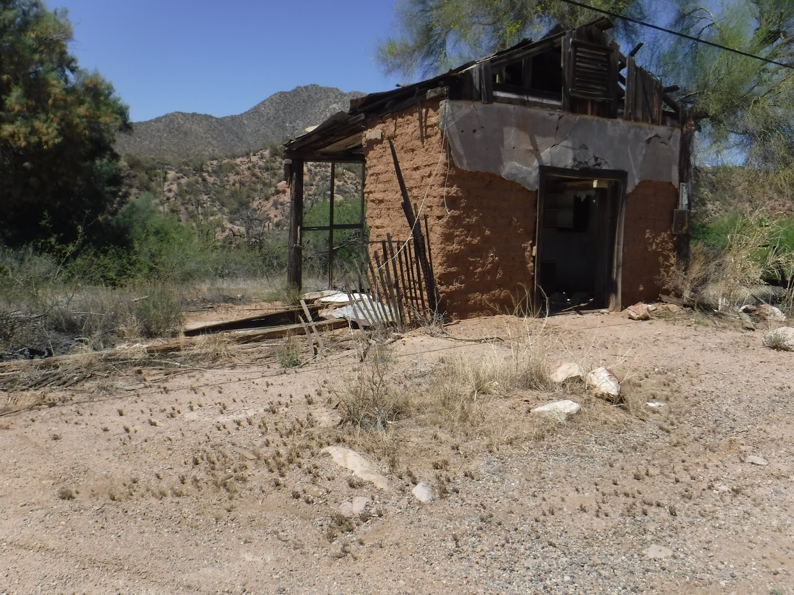
Old adobe at Riverside along the Gila
(c) 2018 MJ Miller

The stagecoach carrying the Apache prisoners - including the notorious Apache Kid - stopped at Riverside in the late afternoon on November 1. There, they overnighted. William T. Branaman, a stagecoach driver himself, opted to guard the prisoners overnight for $5 rather than drive the stage in the morning.  Starting afresh at five the next morning, they left idyllic Riverside (and Branaman) behind, Eugene Middleton driving the stage while Holmes and Reynolds tended the prisoners. 

About four miles west of Riverside, the stagecoach reached Zellweger Wash, the low point at the base of a long, steep grade. The deep sand made the haul tougher on the horses. The prisoners were, according to Branaman's later account, numb with cold. Reynolds allowed six of the eight prisoners - one Mexican and seven Apache - to get out of the stage and walk up the hill, partly for their own warmth and partly to help the horses ease up the grade. The prisoners who got out were shackled; the Apache Kid remained in the coach with one other prisoner and the driver, Middleton, continued onward with them. He was to wait at the top of the hill until the rest caught up.

The prisoners on foot had planned their escape. As the coach got well ahead, two of them attacked Sheriff Reynolds and two attacked Deputy Holmes, killing both. Middleton heard the shots and assumed the lawmen were shooting the prisoners to quell an attack, not realizing the men had been fatally wounded. The lone Mexican prisoner took Sheriff Reynolds' gun and advanced on the stagecoach, shooting Middleton. As the team of horses bolted on, Middleton fell from the coach with wounds to his head, neck, and side. The Apache Kid intervened as the other Apaches caught up and began to attack Reynolds as well, telling them Middleton was already dead and so not to shoot. 

Middleton, though, was not dead. One of the bullets struck him in the right cheek, exiting at the top of his head; it likely followed the path of least resistance as it traveled upward, rather than entering his skull. He later said he'd "played possum" while the Apaches took his gun, coat, and valuables. They also took the orders of commitment to prison and tore them up at the scene.

Middleton was able to walk back to Riverside and, although the papers at the time reported him as "nearly dead," he lived until April 24, 1929, dying in the apartment complex he owned in Globe. Middleton, a true pioneer, had lived in Gila County since 1876.

Sadly, there's no official monument to the incident along the sandy stretch of road. From my own exploration of the area and the landmarks described in the papers of the time, the grade on which the murders occurred is easily identifiable. Precisely where the incident happened is uncertain; it's midway up the hill and out of sight of where Middleton waited at top. The photo of the road above is my best estimate as to the rough location of the murders.  Nearby is the cross in the top photo. I believe it is intended to mark the death of the two lawmen and may well have been where the tragedy occurred.

Reynolds and Holmes were among the first of Arizona Territory's line of duty peace officer deaths. Should you drive that dusty highway, take a moment to remember them.

The Florence- Kelvin Road
(c) 2018 MJ Miller


Copyright (c) 2018 by Marcy J. Miller * All rights reserved * No part of this content, including photographs, may be reproduced without the express permission of the author * Links, however, may be freely shared * Thank you for linking, liking, sharing, forwarding, and otherwise helping grow my audience * Most of all, thanks for stopping by.


Sunday, April 15, 2018

The Bridges of Kelvin and Riverside, Arizona

The Old Kelvin Bridge at Riverside, Arizona
(c) 2018 MJ Miller
The Gila River barely flowed this afternoon, relaxed by months of drought and little snowmelt. Like any of Arizona's rivers, it has a ferocious, voracious alter-ego during heavy rains. Our rivers divide communities in the literal sense during the most productive storms; our bridges are lifelines. Our historic bridges spanned the waters beneath old wagon and stagecoach roads; slowly, motorized vehicles and blacktop took over.  Although many of our early state bridges have vanished, enough remain to make bridge-hunting a rewarding pursuit. In recent decades the new bridges have risen above and near the historical bridge, and a few older bridges have been converted to pedestrian bridges or have been abandoned but not demolished. 

The Riverside / Kelvin / Ray Junction area along the Gila is a joy for bridge-chasers. Turn off the highway onto the old Florence-Kelvin Road and you'll find a new bridge under construction. In its shadows is the old Kelvin Bridge just below it. Showing its age in the deteriorating concrete and the single-lane scale, it's a graceful reminder of the elegant and attractive designs once employed in civil engineering projects. Designed by Daniel Luten, an Indiana engineer famed for his patented concrete-arched bridge designs, the Kelvin bridge no longer has its original decorative guard rail but retains its sweeping grandeur. Built in 1916, it is on the original stage road that connected Globe and Florence via Kelvin and Riverside. On that road, not even five miles away as you head toward Florence, Sheriff Glenn Reynolds was murdered by Apache prisoners he was transporting in 1889. 


The Old Kelvin Bridge
(c) 2018 MJ Miller

It is an idyllic area. Swallows build mud nests beneath the bridge. On the southwest edge of the bridge is a quiet hiking trail; one leg leads to the river banks and the other leads farther than I had time to walk it. Hawks, bright yellow finches, and cardinals were nearby in the cottonwoods and salt-cedars. 


The Kelvin Bridge Placard
(c) 2018 MJ Miller

The new Kelvin Bridge looms over the 1916 Luten bridge.
(c) 2018 MJ Miller

The Kelvin Bridge is actually in the community of Riverside, a territorial town where once Eugene Middleton, the stagecoach driver wounded during the murder of Sheriff Reynolds, resided. Middleton came to Arizona Territory in 1874 and stayed until his death in Globe in 1929.

A third bridge at the Kelvin Bridge site: a working bridge for construction crews.
(c) 2018 MJ Miller
Mud swallow nests cling to the bridge's underside.
(c) 2018 MJ Miller

The town of Kelvin itself was consumed, as much of the area's settlements were, by the Ray Copper Mine operations. That vast mining operation is responsible for the small Copper Basin Railroad that makes its way back and forth throughout the area. With that railroad came the gorgeous but purely functional iron bridges across the Gila.

A Copper Basin Railroad Bridge near Ray Junction
(c) 2018 MJ Miller


Abandoned bridge near Ray Junction
(c) 2018 MJ Miller

Just south of the Kelvin bridge, where the 177 and 77 meet, is the abandoned concrete bridge above. It angles across the road to what was once the old wagon road, now replaced by the paved highway, crossing not the Gila River but one of the larger creek beds feeding it.

A small bridge on the Ray Junction / Kelvin Road
(c) 2018 MJ Miller

The terrain throughout the region is rugged and ever-changing. Dotting the landscape are small concrete bridges across the channels variably known as ravines, washes, arroyos, creek beds, and coulees that texture the land.

Ethan and Me at the Copper Basin Railroad Tracks

I have Jerry A. Cannon and his co-author Patricia D. Morris to thank for my relatively recent appreciation of Arizona's bridges. Until I began packing a copy of their Arizona's Historic Bridges, I too often drove over, passed by, or stopped and photographed our scenic, historically significant bridges without knowing their history or importance. I recommend Jerry's book for your own Arizona history library:  Arizona's Historic Bridges (affiliate link).

Copyright (c) 2018 MJ Miller * All rights reserved * No part of this content may be reproduced without the express permission of the author * Thank you for liking, linking, sharing, tweeting, and otherwise helping grow my readership * Most of all, thanks for visiting and sharing my love of the west!

Wednesday, April 4, 2018

An Apache Trail Outing

My childhood was filled with adventures by proxy: my father's return from his frequent outdoor expeditions always included his tales of Arizona history and sights. An avid outdoorsman and amateur historian who'd moved to Arizona by the 1950s, he took every opportunity to venture out in his faded blue Land Rover whether it was to go rockhounding, gold panning, hunting, fishing, or visit historic locations.

Although I was too young to accompany him on all his adventures, I cherish the memories of those I did participate in - and the ones I missed, I'm catching up on now.  Others, I was too young to well recall, and I'm repeating them now with camera in head. One stretch of twisting, winding dirt was particularly notorious. Dad (sometimes with my mom bouncing along white-knuckled beside him) drove the Apache Trail on many occasions; I can barely distinguish between my own youthful memories of it and Dad's references to it as a treacherous piece of road.

Tortilla Flat
(c) 2018 MJ Miller

The Apache Trail is somewhat tamer now, but no straighter nor flatter. The first part of the journey - because you want to take it from Goldfield north rather than from Roosevelt south - is paved, and offers an opportunity for the less adventurous to enjoy the trail without hitting the winding washboard slopes. If you count yourself among that group, consider a trip to Tortilla Flat for lunch. Stop at the Superstition Mountain Museum on the way; enjoy some views of Canyon Lake below it; enjoy the atmosphere at Tortilla Flat; and by all means have some prickly pear ice cream at the shop next to the restaurant before you head back to urban mayhem.


Tortilla Flat
(c) 2018 MJ Miller

The restaurant is generally packed on even weekdays, drawing tourists from all over the world, so get your name on the list (there's going to be a wait) before you visit the tourist shop. Take some time to appreciate western kitsch and choose a souvenir or two. Don't miss the guacamole when you win the "your table is ready" lottery!


Fish Creek Canyon
(c) 2018 MJ Miller

Should you decide to continue onward (and high five to you, intrepid traveler!) make sure you've got fresh batteries in your camera and someone riding shotgun who can snap photos for you. Wear sensible shoes because you don't want to miss the overlook stops.

My good friends, Jennifer & Steve, who never say no to an adventure and have introduced many to the Trail.
(c) 2018 MJ Miller

The Apache Trail, largely built onto the ancient footpath of the prehistoric Anasazi indians, is a microcosm of Arizona's history. Its story is that of famed scout Al Sieber, stagecoaches, wagons, freighters, dam builders, Teddy Roosevelt, Model A's, Sunday drivers, farmers, water sources, flood control, and fishermen. It features sweeping vistas, deep canyons, historic bridges, and the memories of lives lost. Built as a supply road to the worksite of what would be the Theodore Roosevelt Dam, the road was once called the Mesa-Roosevelt Road. Early territorial tour guides and tourism boosters gave it the name by which it's known today.

Fish Creek Canyon
(c) 2018 MJ Miller
Often described as the most picturesque section of the Trail is the Fish Creek area, including the steep Fish Creek Hill and Fish Creek Canyon below. There's a good pull-out and parking area for you to stretch out, take some photos, and enjoy the breathtaking views. 


The author at Fish Creek Canyon Overlook

A narrow passage approaching a single lane bridge

Sentinels
(c) 2018 MJ Miller

A glimpse of Apache Lake
(c) 2018 MJ Miller


 One of many historically-significant sites along the Trail is the Alchesay Canyon Bridge. Built in 1905 by Apache laborers, the bridge remains today as Arizona's oldest extant vehicular bridge.


Precious, life-giving water
(c) 2018 MJ Miller

The queen-mother of the Trail is the Theodore Roosevelt Dam. Construction began while Teddy was president and, on completion of the masterpiece of engineering, Teddy himself was on-site for the dedication ceremony.

Theodore Roosevelt Dam
(c) 2018 MJ Miller

The dam is taller now than it was on that memorable day. The maximum flow was initially under-estimated. Seventy-seven feet have been added to the top to handle the higher levels of water. The dam resolved water supply issues as well as addressing the frequent flooding the valley suffered in territorial days as water surged down the Salt River.

The stunning Roosevelt Bridge
(c) 2018 MJ Miller

The reservoir created by the dam is Roosevelt Lake, popular with fishermen and boaters. Dad used to fish there frequently in his old bass boat. I don't know if, as he fished, he thought about the one-time community of Roosevelt far beneath the boat's bottom. Wherever large-scale infrastructure projects were built in the territory, pop-up towns were built to accommodate construction workers. Just as Frog Tanks lies beneath Lake Pleasant, once the site of a thriving community of dam-builders and their families, so lies Roosevelt, having served its purpose. Of those dam-builders, 44 died in the construction of Roosevelt Dam.

Roosevelt Bridge
(c) 2018 MJ Miller

Our final site of note on the Apache Trail was the Roosevelt Bridge. Arguably the most elegant bridge in Arizona, this arch bridge is reminiscent of a rainbow. For scale, see the close-up photo (two pictures above) and note the size of the car. This bad boy is a massive, daunting structure - and so large it isn't the least bit intimidating to drive across even for the most bridge-wary driver. 

Should you decide the Apache Trail isn't for you but the views of the lake, dam and bridge are irresistible, take the alternate route from the Beeline Highway to the Roosevelt exit. You'll pass through scenic pastoral land as well as the communities of Jake's Corner, Punkin Center, and the historic Tonto Basin. 

To fully appreciate the drive, you might want to pick up a copy of Richard L. Powers' Images of America: Apache Trail before you go. Available in the Superstition Mountain Museum bookstore in Gold Canyon, you can also purchase it here: Images of America: Apache Trail (affiliate link). The book features vintage photos of the Apache Trail scenery, early drivers and freighters, and construction of the Roosevelt Dam, with a good overview of the history. 

If you love historic bridges as I do, I recommend packing a copy of Images of America: Arizona's Historic Bridges by Jerry A. Cannon and Patricia D. Morris. You can purchase a copy here: Images of America: Arizona's Historic Bridges (affiliate link).  Mr. Cannon is a structural engineer and in addition to the book's historic photos and background, he provides an expert's guide to the types of bridges and information specific to their construction. I fear my copy will soon be tattered as I explore the bridges he and Ms. Morris have featured.

Copyright (c) 2018 by MJ Miller * All rights reserved * No part of this content, including photographs, may be reproduced without the written permission of the author * Links, however, may be freely shared and are appreciated * Thank you for linking, liking, sharing, emailing, tweeting, and otherwise helping grow my readership * Most of all, thank you for visiting and for sharing my love of western history.