Thursday, November 3, 2022

I Hate Sierra Vista

A mountain view as seen from Fort Huachuca
(c) 2022 Marcy J. Miller


 I usually don't do this. I'm usually a relentless booster of Arizona's smaller cities and towns. I'm a veritable glitter bomb of positivity on most things Arizona. I'm of the "just walk/scroll/pass on by" camp if I see something I don't like. But ... let's have a courageous conversation about Sierra Vista. 

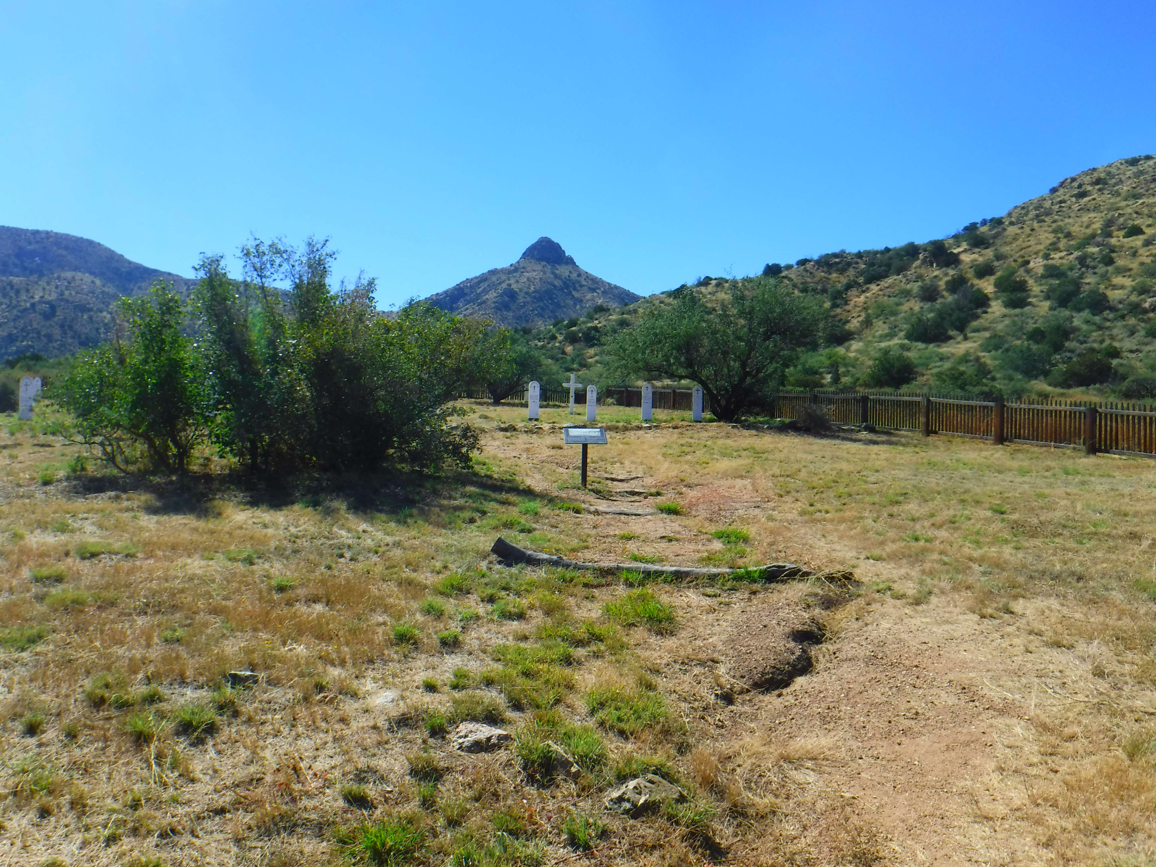
The name is lovely, I'll give it that. Sierra Vista! Mountain views! And those mountain views, of the nearby Huachuca Mountains, are stunning. To the south, you've got the Whetstone Mountains - also a feast for the eyes. But those Huachuca Mountains! When the clouds are low or the fog rolls in or the winter snows frost the peaks and slopes ... oh man, they're just gorgeous! Granted, I haven't visited too many military bases across the country but I can say that Fort Huachuca has amazing views and is a truly lovely base.

But the city of Sierra Vista ... No, no, nopety nope nope. My "thing" is exploring Arizona's historical sites and researching those who've been there before me. Certainly, Fort Huachuca - established as "Camp Huachuca" in 1877, and home to the famous Buffalo Soldiers - has no dearth of history. And visiting the base is a treat, with excellent museums, a historic parade ground, and many of the original buildings and barracks. But the city itself lacks any sort of historical appreciation or historical focus. Drive through the city and just try to identify any older sites, and sense my frustration. You'll find every sort of lower-end chain restaurant, and just about every chain retail outlet that you need, but don't look for charming older buildings. Drive through downtown, and - wait! That's another issue. 

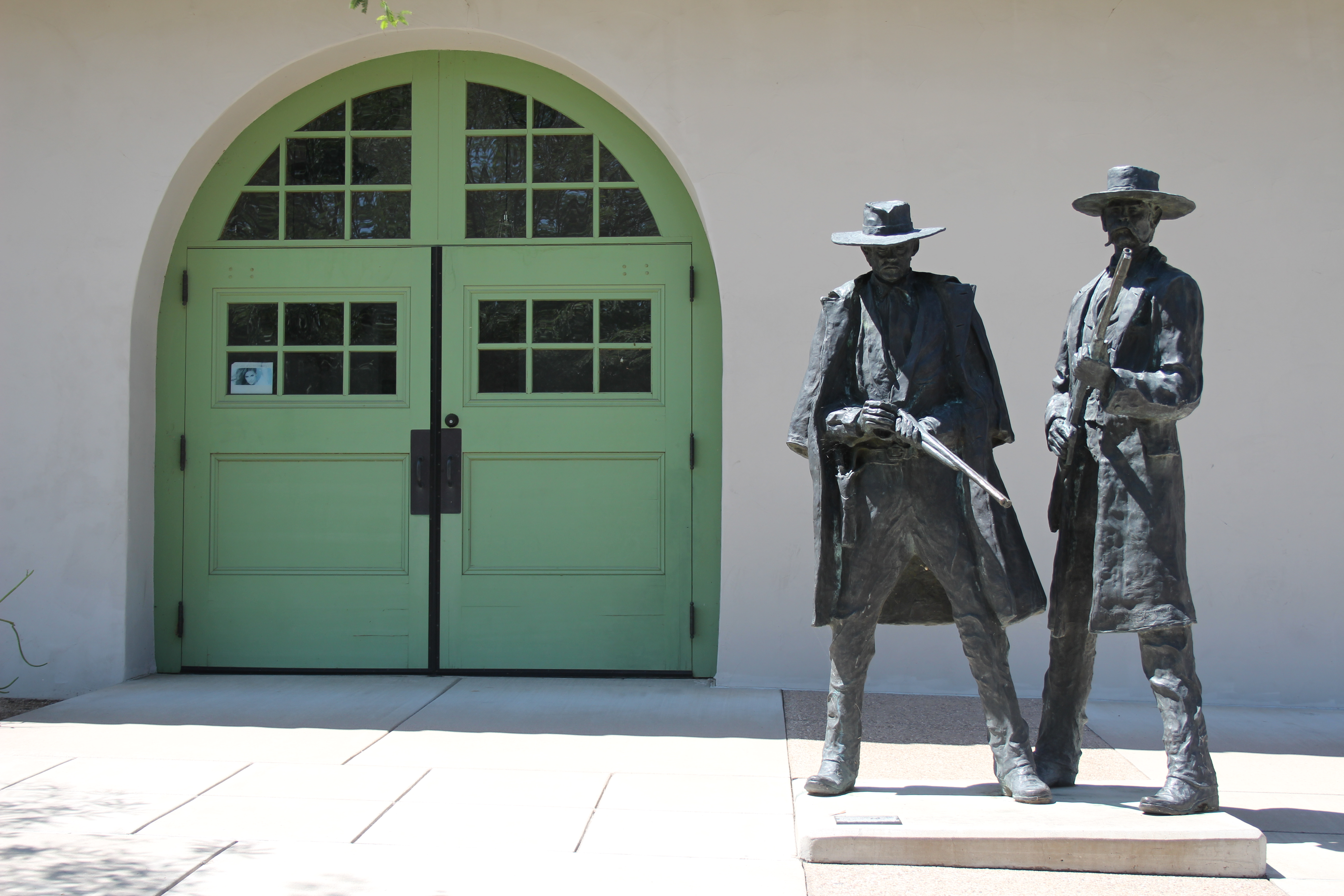
A fine example of public art honoring area history at Fort Huachuca (on base). The surrounding city would benefit from more such works. (c) 2022 by Marcy J. Miller

Sierra Vista doesn't have a downtown. Literally. There's no charming center square. There's no municipal complex. There's no row of older buildings - no "old town" - you'll find in so many cities or small towns. No place to congregate with people you like, or to avoid those you don't. No pedestrian-heavy streets where you can window-shop while toting your pricey Starbucks confection, and no little downtown cafe where you can sit at a yellowed Formica counter and look out upon the street scene. No downtown, folks! None. It's funny how you don't miss a downtown until you realize there isn't one to be had. 

The lack of a downtown also entails a lack of walking points. For those who enjoy leisurely walks through town, Sierra Vista will make you rethink your pastimes. For the profoundly committed walkers, you'll  pass by an occasional street denizen and making your way around the occasional overladen shopping cart, but nothing like the gauntlet you'll run in the Portland or San Francisco urban hells. You'll have some lovely mountain views but the street views? Gah. The weather is usually terrific, but just try to find a streetscape to match it. No lovely, sculpted medians. No public art. No appealing landscapes. No tree-lined boulevards. No nicer neighborhoods. Just grungy, themeless byways. 

Themeless. That's Sierra Vista's theme, overall. The city isn't "tied together" by a unifying motif. It's a military town, and the "Purple Heart City" signs are a welcome sight, but that's about it. What a difference some bronze sculptures of military figures would make. (There are some outstanding bronze statues on the base, but I'm talking about the rest of the city.) Imagine a trio of bronze, life-size Buffalo Soldiers at the city's western edge, or a pair of early lawmen at the north-eastern gateway to the city. This is an area that could easily capitalize on some very real historical charm ... but nah. You get a crazy quilt of businesses and residential areas and a particularly off-putting street layout that prides itself on a plethora of "No U-Turn" signs, which are particularly frustrating since the street medians prevent you from making left turns. 

But that's not all! Sierra Vista is peopled with weirdness. Weird people offering sub-standard service in grungy businesses. For a real-time example of this weirdness and retail hell, try to pick up a prescription at the local Walgreen's. I kid you not. You'll want to stab yourself in the eye with a pencil while standing in the long, long, slow line. Or visit Denny's on a holiday when nothing else is open and you're desperate for a bite. There are bright spots, for sure: the Vietnamese restaurant, Peacock Restaurant on Fry - one of the very-rare independent businesses in town - which offers excellent fresh cuisine. (Cuisine is a word I rarely attach to Sierra Vista.) And of the many, many soulless chain restaurants there, I recommend the Native Grill and Wings, the Texas Roadhouse, or Panda Express. (Many of the businesses in town haven't figured out "If you can't be competent or pretty, you can still be friendly!") I absolutely adore the staff and facility at New Frontier Animal Medical Center (one of the few businesses that has a lovely landscaped front and a grassy expanse). Top-notch customer service, outstanding veterinary care, and pleasant surroundings (because of course, its founder is Dr. Prevatt - who also co-founded the once-amazing Animal Health Services in Cave Creek). 

One of the best feed stores I've frequented is on the outskirts of Sierra Vista, as well. Jem's Feed on Moson Road is fantastic. And Sierra Vista also boasts a Tractor Supply outlet and the queen-mother of rural chain stores - CAL-Ranch. There's something to be said for the convenience and predictability of having chain stores in your town - but they'll never have the special nature of independent, locally-owned businesses. Sure, there's a Home Depot, and I'm thankful it's there; and an Ace, but they can't compete with the customer service you'll find up the road at Redding's Hardware and Goods in Tombstone, where the owner will not only help you find what you need, but tell you "if you have an emergency in the middle of the night, call me and I'll meet you here!" The Ace in Sierra Vista, by the way, is appropriately near the ax-throwing place, which is perfect because if any place is going to make me want to throw an edged weapon, it's Sierra Vista.

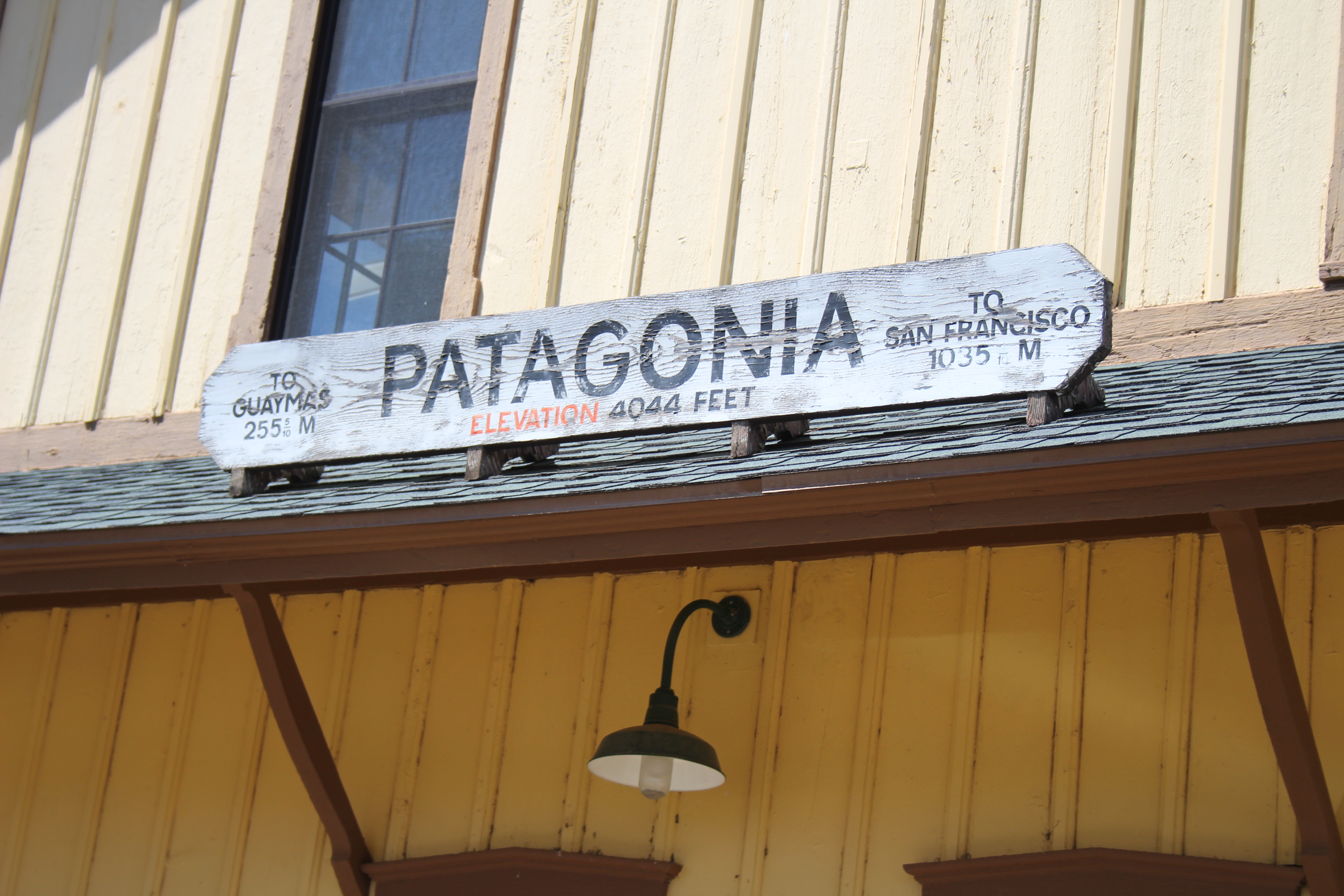
Sadly, Sierra Vista features many, many vacant and even boarded-up businesses on its main streets, from the Golden Corral to a good number of non-chain retail sites. It's neither vibrant economically nor nostalgic in its decline. People struggle here, as they do in just about all of the border region of Arizona, but you don't have the "we're in this together" attitude you get in Elfrida, St. David, or Willcox, and you don't get the "we love that you're spending tourist dollars here" welcome that you find in Tombstone, Patagonia, or Bisbee. There's more of a sense of desolation.  

Here's a rabid generalization: The people of Sierra Vista aren't, well, very pleasant. They aren't well-groomed, they aren't well-mannered, and they aren't going to go out of their way for you. From the woman  opening the bags of grapes, fondling them, and popping a meal's worth into her mouth while "shopping," to the grumpy-ass pharmacist at Walgreen's, you're not going to find a lot of customer service gems.  It makes it all the more exceptional when the teenage boy at the fast-food drive through stops while handing me my order, makes eye contact, and says, "Thank you for being nice." It's one thing to survive being a customer in Sierra Vista, but damn, it's got to be tough being part of the workforce in that population. I love the young man at CAL-Ranch who told me, "God bless you," after I thanked him for helping me out; what a difference a gesture like that makes. There are nuggets of gold in that leaden morass of a city, and I hope people treat them kindly. Little, humble Benson, my other grocery alternative, is the opposite. It's not an affluent area. There's no huge tax base. But the people are kind, helpful, pleasant. The restaurants in town are generally independently-owned, and the owners take pride in their establishments. It's not a fancy area, but it's always a pleasure visiting there. And they cherish their rich history and their community.

Oh, Sierra Vista. I so wanted to love you. I didn't expect to see the hollow faces of meth addicts in your gritty grocery stores. I was surprised to find that a community of military families and retired folks has turned Sunday shopping into a combat sport at the Fry's. I remain shocked that there's little visible historical appreciation of your amazing past outside the gates of the base. I am dismayed you haven't landscaped a city to match the utterly breathtaking surrounding areas you are so blessed with. Why, Sierra Vista? Why?

And for the traveler in the area, take advantage of the nearby hiking trails. Take a drive to Coronado National Monument, to the south, and bask in some of the prettiest wilderness areas you'll see. Visit the birds at Ramsey Canyon. Heck, there's even a Mammoth Kill Site of anthropological interest a short drive out of town. The world famous Kartchner Caverns aren't far away. There's SO much to do in the surrounding areas. But brace yourself for the ugly weirdness that is the city of Sierra Vista. 

Am I too harsh? Give a shout-out to what's right in Sierra Vista in the comments. I'd love to be proven wrong.

(c) 2022 Marcy J. Miller * All rights reserved * No part of this content, including photographs, may be used without the written permission of the author * Links and shares, however, are greatly appreciated! * Thank you for stopping by.


Monday, October 24, 2022

Roster of the Dead at Fort Bowie Cemetery, Cochise County, Arizona


Post cemetery, Fort Bowie. Helen's Dome features in the background. (c) 2022 Marcy J. Miller


Almost two dozen bodies remain interred at this secluded spot at the northern tip of the Chiricahua Mountains. Surrounded by stunning landscapes, the souls here know a peace that eluded them during their abbreviated lives. Many were killed by their enemies; now they are united with them in death. 


The humble gateway from the cemetery, looking toward the north. (c) 2022 Marcy J. Miller

At one time this graveyard was filled with soldiers and their families, but after the closure of the post, the military exhumed their bodies and transferred them. They left behind the civilians, including members of the Chiricahua tribe.


The dead remaining here include Apache children, including one little girl named Marcia.


Grave of Little Robe (c) 2022 Marcy J. Miller

The toddler son of Geronimo, Little Robe, died of dysentery, a common affliction. 


The military's Record Book of Interments offers a semi-chronological register of those buried at the post cemetery. From what I can make out the handwriting in the record book, I've compiled a roster (likely incomplete) of those once buried in the cemetery. I've furnished additional information from other sources for selected individuals. Some dates and details do conflict with other records; I've tried to fact-check when possible and indicate the conflicting information. Note that the register likely was not completed as each body was buried, as the handwriting is the same for nearly every entry, and entries don't always appear in order. As remains were brought in from other locations, the information on their death dates was entered retroactively. The Apache children mentioned above do not appear on the military roster of those interred here.

The first person recorded in the register was Albert Schmidt of the 1st California Column of Volunteers. Of unknown rank, Schmidt died on June 25, 1862. On the same day, Peter R. Maloney and J. F. Keith perished as well. They, too, were of unknown rank and were in the same regiment with Schmidt.

On July 15, 1862, Sgt. C. M. O'Brien and Pvt. John Ba?? (illegible; appears to be "Bam") were killed in the Battle of Apache Pass, but their remains were not brought to the cemetery until 1891. Newspapers of the time said nine people were killed in this skirmish, and that one appeared to have been burned at the stake. One newspaper cited the following names of victims, but none appear to be those listed in the official register at the fort: Thomas Buchanan of PA; William Allen of IL; Conrad Stark of OH; William Smith of PA; David Berry of IA; James Barnes, an Irishman from WI; James Ferguson, an Englishman; and two unidentified Mexicans from Mesilla. 

On May 23, 1863, Wells died and was interred in the cemetery.

New Mexico "A" Company Infantryman of the 1st Regiment, Vivian Lucero, joined the dead on July 24, 1865. 

On August 2, 1865, Samuel Payson, S. Company, 1st Regiment of the California Column, died.

On October 6th, 1865, William Carmichael died.

February 1st, 1866: 1st Lieutenant Juan C. Tapia of the New Mexico Infantry.

August 16, 1866: Pvt. John Walters of G. Company.

February 19, 1867: Pvt. Capius A. B. Fisher of the 1st California Column. 

June 6, 1867:  Pvt. James McIntyre. 

August 6, 1867: Pvt. James F. Walker.

(c) 2022 Marcy J. Miller


Lieutenant John Slater died November 5, 1867. Born in 1832 in Ireland, he was a lieutenant in the 5th Regiment. 

1st Lieutenant John Carroll of the 32nd US Infantry died November 5, 1867 as well. 

May 26, 1868: John Brownley, a citizen.

May 26, 1868: Pvt. George Knowles of D. Company, 32nd US Infantry.

May 26, 1868: Pvt. Robert King, D. Company, 32nd US Infantry.

August 19, 1868:  Pvt. Daniel Rock, D. Company, 32nd US Infantry. 

On September 15, 1868, young Georgie Macomber, the child of First Lieutenant George Macomber, died. The following year, on September 19, the child's father died when a derrick fell on him. 

February 18, 1869: Capt. John M. C___ (illegible) of the 4th California Column died. 

(c) 2022 Marcy J. Miller


John Finkle "Colonel" Stone, listed as a citizen in the Record Book of Interments, died on October 5, 1869, when he was killed by Apaches near Dragoon Springs. Born in New York in 1836, he lived throughout the west and at one time served as a Deputy US Marshal in New Mexico. In 1868 he co-founded the Apache Pass Mining Company and it was while doing work related to this venture that he was killed while enroute from the Pass to Tucson. The Weekly Arizonian eulogized Stone, stating ""Many a good and gallant man has fallen by the hands of the Apache, but none who will be longer or more sincerely lamented than John F. Stone." 


November, 1870: John Kelley, citizen. 

On December 17, 1870, many perished: J. G. Duncan, citizen, and seven others who were listed as "unknown." 

Unreadable date, 1871, 1st Lieutenant Thomas Mooty or Moody

July 18, 1871: Julian Aqueira

October 1, 1871: Pvt. A. Andrews. 

January 24, 1872: A. Bice, citizen. F. Pilly, citizen. T. Donovan, citizen. McWilliams, citizen. 

June 10, 1872: Mary McDonnell, child. 

June 15, 1872: Son of Marajildo Grijalva, child. Interesting backstory: this boy's father, Marajildo, and mother, Rosa Jorquez Grijalva, were children in Mexico when kidnapped by the Apache in Sonora in 1850. Marajildo was ten; the boy's mother, Rosa, was six. Cochise became well acquainted with the kidnaped children and became their protector. In 1859, Marajildo escaped from his captors and eventually arrived at Apache Pass, where he ultimately served General Crook as a scout and interpreter. In 1867, Marajildo and Rosa married. After the death of their young son, they adopted two orphaned Apache children to raise as their own. 

July 5, 1872: Pvt. Frederick Auction, 5th US Cavalry. 

August 20, 1872: Tilghman F. Roth, US Infantry. 

February 26, 1873: Isabella Munson, citizen. 

March 3, 1873: Pvt. William H. Patrick.

July 16, 1874: Sgt. William McComb, F Company, US Infantry.

March 25, 1875: Juan Frentes, Mexican citizen. 

August 1, 1874: Major Eugene W. Crittenden. Crittenden enlisted in the regular army in Kentucky in 1855, ultimately being promoted to major in 1866. He'd arrived at the post on November 15 of 1873. Major Crittenden died of apoplexy. Territorial newspapers lamented his passing and cited his honorable, industrious career.

October 11, 1875: N. M. Rogers, citizen. Although his death date is listed as given here, newspaper accounts of the time indicate he was murdered at the same time as O. O. Spence, immediately below the next photo.


(c) 2022 Marcy J. Miller


1876: O. O. Spence, "killed by Indians." The post record indicates his death date as April 23, 1876, which conflicts with the April 7th date on his grave marker (and the latter which contemporary papers cited as the accurate date). Spence was a citizen. Spence and Rogers had been sitting outside the house at the Sulphur Springs Station when two Apache, Pi-On-Se-Na and his unidentified nephew, both drunk on whiskey, arrived on horseback and opened fire on the men. Rogers died instantly but Spence made his way into the building to grab a Henry rifle, but succumbed before being able to return fire. One of the attackers had allegedly killed two of his own sisters before the assault on the men at Sulphur Springs. Spence had been an employee of Mr. Rogers at Sulphur Springs. This attack ended three years of relative peace. 

Private Daniel Wallace died the same date. 

October 30, 1876: Pvt. Adam Eckstien (probably correctly spelled Eckstein), G Company.

November, 1876: Pvt. Thomas Rofs, L Company. 

December 22, 1877: James Stapleton, H Company. 

January, 1878: Pvt. Henry Stone, L Company.  

July 11, 1878: Lieutenant Austin Heneley and J. A. Rucker died. Rucker was later removed to Arlington. 

On August 9, 1878, Private Nicholas Marringer, a blacksmith, was struck by lightning while heading uphill  towards his quarters. The official report described him as having died instantly, while not more than five feet away, children were uninjured. In addition, he was passing among three different sets of buildings that each had higher points than Marringer's height, yet none of the buildings were damaged. The author of the report on the incident noted that Marringer's clothes were likely filled with iron fragments and dust due to his occupation, which may have contributed to the selective nature of the bolt from above.

January 30, 1879: Pvt. Thomas Dowdell, E Company. 

February, 1882: Pvt. Charles P. Laging, M Company, US Cavalry. 

January 29, 1883: Pedro Valdez, citizen. 

March 10, 1883: Pvt. M. Shuck Ormsby, US Cavalry.

H. H. Nickause, Saddler, 4th Regiment, US Cavalry.

Pvt. Dezo Vislavki, C Company, 4th US Cavalry.

Pvt. Phillip O'Neill, 4th US Cavalry. 

Pvt. William C. Drake, G Company, 4th US Cavalry.

Pvt. William Bray, 9th Regiment, Infantry.

Sgt. C. M. O'Brien, 1st Regiment, US Cavalry. 

June 8, 1891: Mabel, infant daughter of Sgt. Phillip Roth. 


To visit the cemetery, park at the Fort Bowie trailhead and hike a short distance along the well-marked trail to the cemetery. There are bathrooms at the trailhead at Apache Pass. Wear appropriate shoes for desert terrain, and take water. This is the same trail that extends to the ruins of Fort Bowie itself - one of my new favorite sites. That hike is well worth every step of the 1.5 miles to the Fort. In all, you'll hike over more than four miles by the time you visit the many spur trails along the way. If you have the energy left for a little more rugged terrain after you've seen the ruins at the fort, take the Overlook Ridge Trail back to the parking lot. It offers spectacular vistas in both directions. 

Copyright (c) 2022 Marcy J. Miller * All rights reserved * No part of this content may be reproduced without the express permission of the author * Thank you for sharing links and for stopping by * Please subscribe to my blog, buy my books, and keep my donkeys in hay * 


Wednesday, October 19, 2022

Apache Spring, Cochise County, Arizona

 Stopping at this tranquil, Edenic spot on the trail to the ruins of Fort Bowie, it's difficult to imagine so serene a site was responsible for so much contention and carnage. Here, at this quiet grotto shaded by lush trees and brush, is Apache Spring. 


Apache Spring (photo by Marcy J. Miller)


Even now, the spring produces a trickle of water. Walk another mile or so up the trail and you'll reach a drinking fountain at the ranger station, but in the 1800s, this spring was the only reliable source of water for many, many miles. The water is no longer as pure as it once was, unsurprisingly; don't drink from the spring.


Apache Spring (c) 2022 Marcy J. Miller


For hundreds of years, indigenous people relied on this spring. Ancient pottery fragments indicate pre-historic tribes were here. Later, it was a crucial site for the Chiricahua Apache. Living in impermanent dwellings called "wickiups" built from locally-available plant fibers and branches, the Chokonen band of Chiricahua Apache used this spring's water when in the northern end of the mountain range that took their name, the Chiricahuas. Here, accessed by the pass between Dos Cabezas and the Chiricahua - Puerto del Dado, or "Pass of Chance" - now known as Apache Pass - was one of the favorite camping sites of the great chief Cochise. 

Example of an Apache wickiup and ramada. Fort Bowie National Park. (c) 2022 Marcy J. Miller


The presence of the spring drew Anglo settlers. In late 1858, the country's transcontinental mail service - the Butterfield Overland Mail Company - established a stagecoach stop at Apache Pass not far from the spring. The station was off to a bad start when the station keeper, Anthony Elder, beat and humiliated a Chokonen warrior in retaliation for an Apache raid on the Santa Rita Mining Company's stock. Facing severe revenge from Cochise, Elder was transferred away from the Pass.


Ruins of the Butterfield Overland Stagecoach Station at Apache Pass. (c) 2022 Marcy J. Miller


The station keeper who succeeded the impetuous Elder, James H. Tevis, presided over the Apache Pass station from 1858 to 1859 and grew to know Cochise. This was during a two-year period of peace with the Chiricahuas, with an unwritten understanding between the band and the Americans. The Apache, in return for provisions, would refrain from attacking and looting Americans. This agreement did not, however, offer any protection to those on the other side of the border. Throughout this time, Cochise actively offered protection to the Americans, including mail carriers and facilities, even going so far as to kill one of his own warriors who breached that trust by carrying out a raid on livestock in the Patagonia area.

By late 1859, the fragile peace between the Chokonen people and the Americans began to break down. Numerous tit-for-tat conflicts began to escalate until, in 1860, Cochise commanded a war party below the border, murdering dozens of Mexicans, murdering four more while heading back to the north. Well back into Arizona Territory, the raiders eventually struck the stage station at Dragoon Springs, stealing livestock. Word got back to the Butterfield station at Apache Pass that they would soon be targeted. 

By January, 1861, relations had deteriorated to the point that the scene was set for the unfortunate, devastating Bascom Affair. An inexperienced officer, First Lieutenant George Bascom, botched negotiations intended to recover a young boy named Felix Ward who'd been kidnapped by Apache during a raid. Despite indications the boy had been taken by Coyotero Apache, not by the Chokonen people, Bascom determined to retaliate against Cochise. In a meadow near the spring and the station, Bascom attempted to detain Cochise and the rather innocuous traveling party with him. Cochise, however, escaped. This bad-faith encounter directly led to the utter breakdown of relations between the Americans and the Chokonens. 

Three unfortunate employees of the Butterfield station opted to get involved with the negotiations with the Apache. One, named Welch, was killed at the station's corral (probably by so-called "friendly fire"); a man named Charles Culver was wounded; and the third, James Wallace, captured. 

The next day, on February 6, Cochise's warriors attacked an eastbound wagon train at the summit of Apache Pass. Nine Mexicans were tortured and killed; three Americans were captured. Cochise hoped to use the Americans in trade for his own people. For extra insurance, the following day he attacked the eastbound stage at the summit, three miles from the station below. Despite the attack itself, the wounding of the driver, the killing of a mule in the team, and the sabotage of the already treacherous Butterfield Stage Road, the coach made it to the station in the middle of the night. 

After a day of inactivity on February 7th, Cochise rallied his troops for an assault on Bascom's soldiers at Apache Spring. Thinking the Apache had left the area, brought the Army's entire herd of stock to the spring to water. As the men drove the stock back toward the station, about 200 Apache warriors attacked, unsuccessfully attempting to cut them off from the station. The entire herd, however, was taken and run into the mountains above. Although the soldiers repelled the assault, the Apache returned and attacked again. The US troops fended off the attackers, suffering the death of one Butterfield employee, the wounding of one US troop, and the loss of dozens of mules. At least three of the Apaches were killed. 

Unsurprisingly, the Apache warriors tortured, killed, and mutilated the four prisoners they'd hoped to use in a hostage exchange. The battle was over, but the hostilities were far from finished. Finding the bodies of the four prisoners, the Army commenced to hang the six adult male Chiricahua prisoners from four large oak trees on the west side of Apache Pass. The remaining prisoners, women and children, were released. 

In June of the next year, the US Army sent Brigadier general James H. Carleton and his California Column of Volunteers to the pass to protect Apache Spring. Perched on a hillside above the spring and fortified by an adobe wall, Camp Bowie was established. From that tactical position, the troops could easily fire on any of the Chiricahua who attempted to access the spring. This was the genesis of what would ultimately become Fort Bowie.

The spring itself is easily accessed from the Fort Bowie trailhead. Of note is the geological fault on the mountainside above and north of the spring. The fault is what makes the flow of water from the spring possible. To access the fault on the mountainside itself, take the Overlook Ridge return trail from the ranger station at the fort. Midway along your hike is a well-marked placard pointing out the fault. 

Apache Spring (with the yellowing trees) as seen from the Overlook Ridge Trail. The distinctive peak in the background to the south is Helen's Dome. (c) 2022 Marcy J. Miller 


For further reading, I highly recommend Edwin R. Sweeney's book, Cochise: Chiricahua Apache Chief. You can order it from Amazon here. Disclosure: I may receive compensation from Amazon for purchases made through this link. 

Stay tuned for further posts on Fort Bowie! You can do so by subscribing to this blog.

Copyright (c) 2022 by Marcy J. Miller * All rights reserved * No part of this content may be used without the express permission of the author * Thank you for sharing links to this page! *


Wednesday, August 24, 2022

Historic Tucson Station: Where Wyatt and Doc Shot Frank Stilwell


With Virgil still recovering from his serious wounds and Morgan's body barely cold, on March 19, 1881, Wyatt Earp, brother James, Doc Holliday, and a posse of their allies took Morgan's corpse to Contention to be sent by train to Colton, California. There, the Earp brothers' family compound awaited, headed by their parents, Nicholas and Virginia. James Earp accompanied the body. Louisa Earp, Morgan's frail, rheumatic young widow, had already gone to Colton for safety. 

The following day, Wyatt and company headed to the train station in Benson, southeast of Tucson, to put Virgil and his wife Allie on a train to Colton. Along the way they learned that Ike Clanton, Frank Stilwell, and a couple of other members of the cowboy faction were monitoring the trains in Tucson - where the train from Benson would be stopping. Although Stilwell had verifiable business in Tucson, their presence at the train station and their behavior while there made it clear they were planning to ambush Virgil and finish what they'd tried to do on December 28th, not even three months before. 

Wyatt, now concerned he was about to lose another brother, boarded the train with Virgil and Allie. His friends and posse accompanied him, with Doc Holliday carrying two double-barreled shotguns. On arrival at the Tucson Station, Doc disembarked with guns in hand - where he was promptly met by Deputy U. S. Marshall J. W. Evans, who convinced Doc to check the guns at the station. Evans, however, provided additional protection by his presence. 


The original Tucson Station, built in 1880. 


Wyatt, Doc, Virgil, Allie, and the posse including brother Warren Earp, Sherman McMasters, and Turkey Creek Jack Johnson, had a short layover in Tucson. They enjoyed dinner at the adjacent hotel, Porter's, and then escorted Virgil and Allie back to the train to re-board. The station released the shotguns to Sherman McMasters. 

Antique railroad car at Tucson Station, 2022. Marcy J. Miller photo.


Word got to the group that two men were seen lying on a flatcar towards the train's engine. Wyatt, armed with one of the shotguns, detrained and made his way to the flatcar in the darkness. As he approached, followed by Doc, Warren, McMasters, and Turkey Creek Jack, two men made a break from the flatcar and tried to flee. One of them - perpetual nuisance Ike Clanton - successfully got away into the night, but the other - a terrified Frank Stilwell, one of the gang who'd conspired to kill Morgan - found himself at the end of Wyatt's shotgun. 

By some accounts, such as retold in Tom Clavin's Tombstone, a desperate, shaking Stilwell grabbed at the shotgun barrels, and Earp reacted by jerking the trigger. When Stilwell's body was found after sunrise, it was full of not just buckshot but bullets as well, thoroughly shot up by various weapons. It's assumed everyone in the posse wanted to vent a bit on Stilwell by ventilating his corpse. As luck would have it, Tucson was in the midst of celebration over newly-installed gaslights, and those who heard gunshots attributed them to the celebration. 

The actual inquest into Stilwell's death, though, offered a different perspective. Several eyewitnesses were aware at the time that violence was imminent, and even the engineer on the outbound train, R. E. Mellis, witnessed the flashes from the very audible gunshots and saw a group of four men standing where the shooting occurred. For whatever reason, though, the body wasn't found until the next morning.

The attending physician who examined the body, Dr. Dexter Lyford, testified at the inquest that one charge of buckshot, fired from close range, struck Stilwell's liver, abdomen, and stomach; a rifle ball entered at the armpit and passed through the upper portion of the lung; another ball passed through the upper left arm; a second charge of buckshot struck and fractured the left leg; and finally, a rifle ball went through the right leg. Two of the wounds were deemed fatal by Dr. Lyford.


Lifesize bronze of Wyatt Earp and Doc Holliday, Tucson Station. Marcy J. Miller photo.


Earp and his cohorts, knowing a posse would soon be pursuing their own posse, walked on foot to a station about twelve miles outside of Tucson. Look for "Papago Station" on Google maps and you'll find nothing; other map sites take you to an incorrect site alongside the tracks northwest of Tucson, north of Tangerine Road; but newspapers of the 1880s describe it as 12 miles east of town. Logically, it would be along the tracks heading southeast from Tucson to Benson. That stage station was also known as "Aguirre's Station," and in 1884 Aguirre moved it two miles west (closer to Tucson). Regardless of the exact location, from that station the men hitched a ride on a freight train back to Benson, where they recovered their horses and continued on their way.

Tucson Amtrak Station, 2022. Marcy J. Miller photo.


The site of the shooting of Frank Stilwell is located at 400 N. Toole Avenue in downtown Tucson, but the depot the Earps strode through on their path of vengeance is not the one you'll see today. The original building, built in 1880, showed its age by the turn of the century. In December, 1906, L. Zeckendorf sold a city block bounded by Stone Avenue, Franklin Street, Ninth Avenue, and Sixth Street, to Southern Pacific Company for $11,500. There, construction began on a new 2,964 square foot brick depot, measuring 38 feet wide by 178 feet long. By July, 1907, the Tucson Daily Star headlined an article with, "Freight Yards and New Depot Very Complete." On August 22, 1907, the Tucson Citizen reported that the transfer to the new depot was now complete as Resident Engineer Bordwell's office had been moved the day before. The old building had served for 27 years. (Coincidentally, the day ticket agent at the new depot in 1907 was named Maurice Holliday.)

The 1907 stucco Spanish-revival building remains intact today. To commemorate the Earp / Stilwell incident, a life-size sculpture of Wyatt Earp and Doc Holliday was commissioned of Tucson sculptor Dan Bates and installed in 2005. Within the building is the Southern Arizona Transportation Museum; admission to the museum is free, but - like much of southern Arizona - it is closed on Mondays. Outside, you can see an original steam engine, complete with quite happy railroad cats-in-residence. 


One of the resident cats at the Tucson Amtrak Station on Toole. Marcy J. Miller photo.


Steam engine on display at Tucson Amtrak Station. Marcy J. Miller photos.


Sadly, the Stilwell shooting was not the last law enforcement-involved shooting at the site. In 2021, DEA Special Agent Mike Garbo was fatally shot during a contact with a passenger carrying bulk marijuana on a double-decker Amtrak train. Two other officers, one a fellow DEA Special Agent and one from Tucson Police Department, were wounded in the gun battle. The suspect was shot and killed. Rest In Peace, Agent Garbo. Agent Garbo had served the DEA for sixteen years.  End of watch October 4, 2021.


Copyright (c) 2022 Marcy J. Miller * All rights reserved * No part of this content may be used or reproduced without the express permission of the author * Sharing this link, however, would be greatly appreciated * Thank you for visiting, sharing, and otherwise helping grow my readership


Monday, July 11, 2022

Perfectly Patagonia

 Subtly funky Patagonia, situated between Nogales and Sonoita on southern Arizona's Highway 82, might just be my new favorite little Arizona town, the epitome of adorable. With a history tracing back to Jesuit Father Eusebio Kino's forays into the region in the 1500s, parts of the town reflect the Spanish influence. The train depot, though, is pure turn-of-the-century western, while the small, square, concrete Marshall's Office and jail are 1920s WPA (Works Progress Administration). Other structures hearken back to 1950s road-trip culture, and the Velvet Elvis Pizza Shop adds just-enough-modern-funk to be charming and yet not so much to be ruined by its own preciousness. Open roads in each direction are rich with pre-territorial and territorial-era military history and are pure joy to drive for the varied open terrain. Even on this mid-July Arizona day, when Phoenix-area temperatures rose to 114, at 4050 foot elevation, Patagonia was ideal - the kind of day you'd say, "Yeah, let's sit outside for a while," and enjoy the green hillside views brought to you courtesy of this year's monsoon.


The town's name derives from the Spanish and means "big foot." Some early sources said it was so called for the distinctively big feet of local Indians. The town itself was named after the nearby Patagonia Mountains, which were named after the Patagonia Mine, which had been so-named in 1859 by Lt. Sylvester Mowry, who purchased the mine from a Mexican. The naming origin gets more confusing, though: Originally, Patagonia indicated the post office founded in 1866 at the Mowry Mine, ten miles to the south; the first postmaster at that location was Lt. Mowry's brother, Charles. 

A Pennsylvanian and Civil War veteran by name of Rollen Rice Richardson, made wealthy by eastern oil money, bought large ranch holdings in the region, including Monkey Springs Ranch and the abandoned Camp Crittenden. By 1890, Richardson and his two partners had a vast cattle enterprise but the drought devastated the enterprise. Richardson sold out everything but 500 acres which included the site of today's town of Patagonia. Richardson moved the town of Crittenden, residents and all, to the site in 1896. Sadly for Richardson's legacy, the townspeople refused to support his quest to name the town (via name of the post office) Rollen, but in a turn of good luck for lovers of appealing and interesting names, they chose the name Patagonia for their new town, co-opting the name from the previous post office at the mine. The post office at the current Patagonia was established in 1900 under the oversight of postmistress Mamie M. Cretin.


The mine itself had been a rich source of silver and lead deposits, and Lt. Mowry himself - recently retired from the U.S. Army - was accused by the military of using the mine's lead to make bullets, which he sold to the Confederacy. Lt. Mowry was arrested, charged with treason, and held at Fort Yuma, and the mine confiscated by the Army. Lt. Mowry was never court-martialed and later sued the federal government and culpable army staffers in vain. The marker above is in front of the train station at Patagonia.


The train station, built in 1900, stood along the now-abandoned tracks that were built in the 1880s to connect Nogales to Benson. The peak of the railroad's use came during World War II, when thousands of tons of ore were shipped out of the area's mines each month to support the war effort. As the mines shut down, a preservation-minded citizen, recognizing the significance of the train depot, purchased it.


By the 1930s, the Mowry Mine townsite was a ghost town, but the Works Progress Administration brought some work to the area: the small town jail above was built by WPA crews. The WPA also hired authors to chronicle America and its history; their volume on 1930s Arizona included visits to Patagonia and neighboring areas. 


At the time of the WPA writers' visit, the town boasted 500 residents, considerably more than the 133 who occupied the town when the train station was built. Throughout these decades, the community's Methodist Church, shown below, served the faithful. Built around 1923 by local residents, the elegant stained glass windows were added by local artist Jean Burger in the late 1980s throughout the 1990s. According to the plaque to the left of the door, the window shown here is called "Cross Window and White Rose" and employs the "Tiffany method of stained glass art." 


Across the main road of town, look for the wonderful PIGS station below, a throwback to rural stations of mid-century roadtrips. What's not to love about Patagonia? Even at today's record-high gas prices, a roadtrip to Patagonia - and while you're at it, nearby Sonoita and Elgin - is worth the time and money. If you're from the Phoenix or Tucson metro area, you'll feel like you're in an entirely different state - and no matter where you're from, you'll feel like you're a time traveler visiting an entirely different era.  


Copyright (c) 2022 Marcy J. Miller * All rights reserved * No part of this content, including photographs, may be used without the express permission of the author * Links and shares, however, may be freely shared and are appreciated. All photographs by Marcy J. Miller.

Partial list of sources: 

Will C. Barnes, Arizona Place Names, 1960 edition
The WPA Guide to 1930s Arizona
John and Lillian Theobald, Arizona Territory Post Offices and Postmasters, 1961
Ray Brandes, Frontier Military Posts of Arizona, 1960
Arizona Highways Magazine
On-site placards and historical markers


Friday, July 8, 2022

The Site of the Bisbee Massacre, the Lynching of John Heath, and the Grim End of the Cochise County Cowboys

 As a child, already enthralled by Arizona's history and constantly poring over my Dad's library of books on the subject, I was simultaneously mesmerized and intrigued by a grim photograph of a blindfolded man dangling by the neck from the crossbar of a pole, a dapperly-dressed crowd gathered beneath his feet. His name, John Heath - whatever book I'd first seen the photo in had "John Heith" in the caption - stuck with me. I later learned the backstory of the photo, and over the years I revisited the photo many times in many different sources, first in the brittle pages of fly-jacketed volumes of local history, then online. This morning I visited the site where the photo was taken.


On the southeast corner of Toughnut and 2nd Street in Tombstone, just slightly off the tourist-beaten path to the east, is a historical placard. It stands on the edge of a neatly-kept property with a small, charming picket-fenced cottage, the famous Tombstone Courthouse looming in the background. 


What's most interesting in the larger photo above is the stump of a pole to the left of the placard. That is the stump of the telegraph pole from which Heath was hanged by the angry mob. 

The crime for which Heath had been lynched was shocking to the people of A.T. (Arizona Territory) despite the frequency of violent crimes in the region. Later dubbed "the Bisbee Massacre," it was a robbery-gone-bad. Hoping to rob the Goldwater and Castaneda Mercantile of the payroll for the Copper Queen Mine, members of the Cochise County Cowboys gang tied up their horses down the street to the east, near the smelter for the Copper Queen Mine. They entered the general store only to find the payroll hadn't arrived yet. They did, however, take what was available as well as rob everyone in the store at the moment. They made off with perhaps as much as $3,000 dollars plus watches and jewelry. Citizens nearby recognized a robbery in progress and intervened. The shootings commenced. The first man shot was J. C. Tappenier, an assayer for the mine. Next, a San Pedro rancher and Deputy Sheriff, C. Tom Smith, having dinner across the street, confronted them, allegedly identifying himself as a peace officer. Members of the gang quickly felled him with a shot to the head. They shot lumberman J. A. "Tex" Nolly in the chest, and shot the pregnant proprietor of a boarding house, Mrs. Annie Roberts, who'd come out to see what was going on. The bullet penetrated her spine and later proved lethal. Another man was struck in the leg by a wayward bullet and injured while fleeing, but did not die.


Here - at 26 Main Street, Bisbee - is the Letson Loft Hotel, which now occupies the building that once housed the Goldwater & Castaneda Store, where the Bisbee Massacre occurred. (c) 2022 Marcy J. Miller 


This view, with the former Goldwater & Castaneda Store on the extreme left edge, shows a street view in the direction of where the horses would have been tied. Bisbee's narrow streets didn't accommodate buckboards and horses tied in front of businesses, making a quick getaway difficult. (c) 2022 Marcy J. Miller


Outrage over the brutal, senseless crimes was immediate. Posses quickly assembled and pursued the members of the gang. The first posse, headed by Cochise County Deputy Sheriff William "Billy" Daniels, left Bisbee immediately in pursuit. That posse included none other than John Heath, who'd been deputized for the purpose of pursuing the robbers. 

Meanwhile, the culpable cowboy gang assembled to the north at Soldier's Hole, a historic site east of the Dragoon Mountains and between Gleeson and Elfrida, where they split their haul and then split up. Once serving as a stop on the Butterfield Overland Stage route - among other utilitarian purposes - Soldier's Hole (alternately known as Soldier Holes, Soldier's Holes, and Descanso)  is an unremarkable flat patch of land now commemorated by a historical marker. The robbers gathered there included Omer "Tex" Howard, Red Sample, Daniel "York" Kelly, Daniel "Big Dan" Dowd, and William E. "Billy" Delaney. John Heath knew them from a spread in the Sulphur Springs Valley known as the Buckles Ranch, and once Deputy Daniels was able to identify Tex Howard, suspicion soon fell on John Heath in a clear case of guilt by association. The men were rounded up in various corners of the region: Tex and Red were found north of Clifton; Big Dan and Billy were found across the border in Sonora; and York made it as far east as Deming. 

The men were reunited in Tombstone. After a three-day trial presided over by Judge Daniel Pinney, five of the men - Tex Howard, Red Sample, York Kelly, Big Dan Down, and Billy Delaney were found guilty on February 18, 1884, and sentenced to be hanged until dead. Four of them had been identified by eyewitnesses at the scene of the crime or during their flight immediately afterwards. John Heath, however, was tried separately. No eyewitness tied him to the crime, but a cavalry soldier who'd been locked up with the men testified he'd heard the gang - Heath included - discussing their aborted attempt at robbery. Based on his testimony, Heath was convicted of second-degree murder and sentenced to life at the notorious Yuma Territorial Prison. (The soldier who testified against him, likely in exchange for his testimony, received a lenient sentence at Yuma for the murder he had committed.)


The stately Cochise County Courthouse in Tombstone, Arizona, where the Cochise County Cowboys were tried and convicted for the Bisbee Massacre. (c) Marcy J. Miller


Frontier justice intervened. While the five men who'd been sentenced to death lived on for another m month in jail, awaiting their execution, on February 22, 1884, Heath was busted out of jail by an armed lynch mob and cruelly, slowly strangled to death, drawn up by manually by the neck via the rope slung over the telegraph pole. Guilty, if at all, of nothing more than participating in planning the crime and perhaps attempting to misdirect the posse as the others fled, he faced the cruelest death of all the men. On March 28, 1884, his compadres were professionally hanged on a specially-built gallows behind the Tombstone Courthouse, and all but Big Dan Dowd died promptly when the gallows door dropped. The drop wasn't adequate for Big Dan, though, and he strangled just as Heath had. 

A thousand people were in attendance for the grim display, many of whom paid $1.50 each for a seat in a specially-constructed grandstand. The bodies hung for about half an hour before being cut down and removed to the mortuary for examination; all but Omer "Red" Sample died of strangulation. He, being more fortunate than the others, incurred a dislocated neck during the hanging. The bodies were given a Christian burial at nearby Boot Hill Cemetery where, just as during the execution, visitors continue to find them a source of entertainment. John Heath's body, initially interred there as well, was later relocated to his home state, but a less-reverential resurfacing was spared his partners in crime. The "Angel of the Mining Camps," famed and kind-hearted Tombstonian Nellie Cashman, prevented the condemned mens' bodies from being dug up and used for medical research. She arranged for local miners to guard the graves for ten days and prevent exhumation. It was Nellie, too, who was horrified by the spectacle that attended the mens' execution, and arranged for the destruction of a viewing platform for the audience. 

All the men proclaimed their innocence to the end, claiming they were judged wrongly based on their own reputations, but unlike Nellie Cashman they were no angels. Billy Delaney's own frequent proximity to newly-dead corpses gives a glimpse into his character; on the day of his execution, he spoke with reporters. Billy, apparently much-misunderstood throughout life, said he was born on July 11, 1856, in Scranton, Pennsylvania, and later "was supposed to have left Harrisburg under suspicion of a murder, of which I am innocent." He went on to say he'd lived in Arizona Territory for four years as a miner and prospector and was indicted in Graham County for shooting a man through the heart after the man intervened in an argument between Billy and a Mexican woman, but - Billy averred - "I am entirely innocent of this crime," and stated he was misjudged based on his own reputation.  The Arizona Daily Star described him as a "short, well-built man about five feet four inches in height; he has clear, intelligent eyes, black hair, a well-developed forehead, and expresses himself in a gentlemanly language." 

Twenty-four year old Missouri-born Omer "Red" Sample also avowed his innocence on the gallows, saying "I am to be hung for a crime I never committed." The paper described him as a "splendid specimen of physical manhood," and 6'1" in height, already suffering from a gunshot wound in his side and "of a brutal countenance." The writer described Daniel Kelly as 25 years old, with a very dark complexion, 5'6" tall; Tex Howard was 24, born in Texas, and with an intelligent, manly face - and real name unknown. Daniel Dowd was 27, 180 pounds, and had come to Arizona four years previously. He, Howard, and Delaney echoed Red Sample's proclamation of innocence in the moments before Kelly said, "Let her loose!" and the gallows trap was sprung. 

Shortly after the crime had occurred, and while the gang was still on the run, another paper, the Weekly Republican, via the Benson Herald) provided physical descriptions of the men as well. Red Sample - called "Big Red" in that edition - had light hair, very red complexion, and a badly crippled right hand from partially-healed gun shot wounds, with part of his thumb shot off. Big Red had a distinctly receding chin and round shoulders. Dan Kelly was "splendidly built" and had a thin mustache, while Tex Howard - called simply "Tex" in this article - was a well-built 5'11, 160, with light brown hair and a light complexion. Mis-understood Delaney had a mustache, too.

As for ill-fated John Heath's physical countenance, he was described as 5'6", 150, with a dark complexion, very black hair, and very dark mustache - and a glass eye on the right side. 


The tidy cottage now standing on the corner where John Heath was lynched. The telegraph pole from which he hanged is to the right side of the picket fence on the right edge of the lot. This view faces south. (c) Marcy J. Miller


(c) 2022 Marcy J. Miller * All rights reserved * No part of this content may be reproduced, including photos, without the express permission of the author * Links to this page may be freely shared and are appreciated! Thank you for stopping by.