
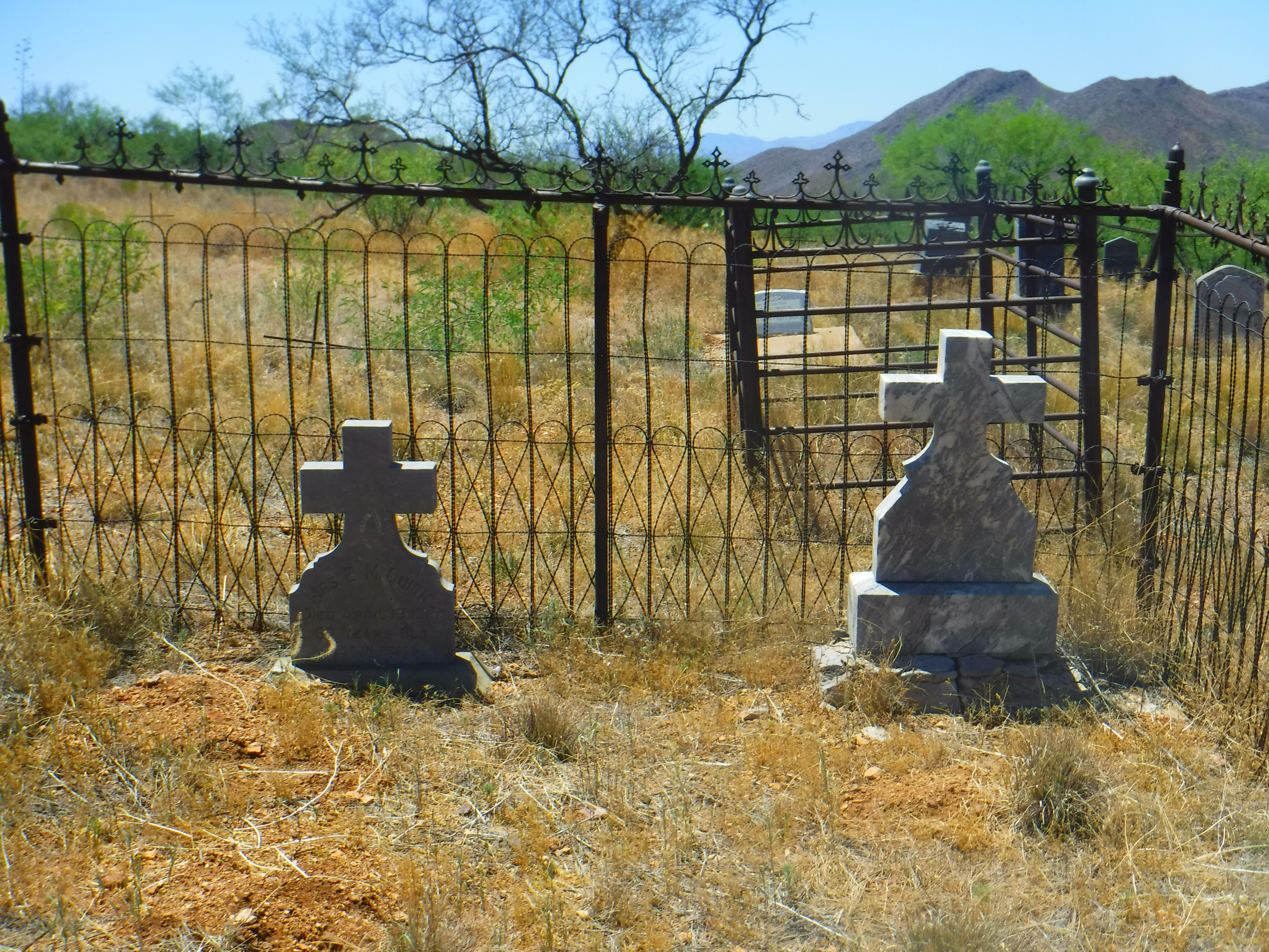
Nestled into the Dos Cabezas Mountains toward the northeast corner of Cochise County lie the remains of some of Arizona Territory's most rugged, independent pioneers - cattlemen; peace officers; Mexican laborers; veterans of the Indian Wars, both World Wars, and other conflicts; German immigrants; Freemasons; and the gutsy women who accompanied them to this harsh land.
A few historic adobes still dot Dos Cabezas itself. Just a few miles west of Fort Bowie, and fifteen miles from Willcox, the settlement was originally called Ewell's Station, named for Dragoon Captain Richard S. Ewell. It originally attracted fortune-seekers drawn to the gold and silver in the surrounding mountains. Ranchers, lured by the tall grass- and yucca-covered range lands, brought in livestock. A stagecoach station served the Birch Line (called affectionately the "Jackass Line" due to Birch's dependence on mule teams). Dos Cabezas ("two heads") derived its name as far back as the 1840s for the distinctive pair of bald peaks - two heads - that jut prominently from the surrounding peaks.
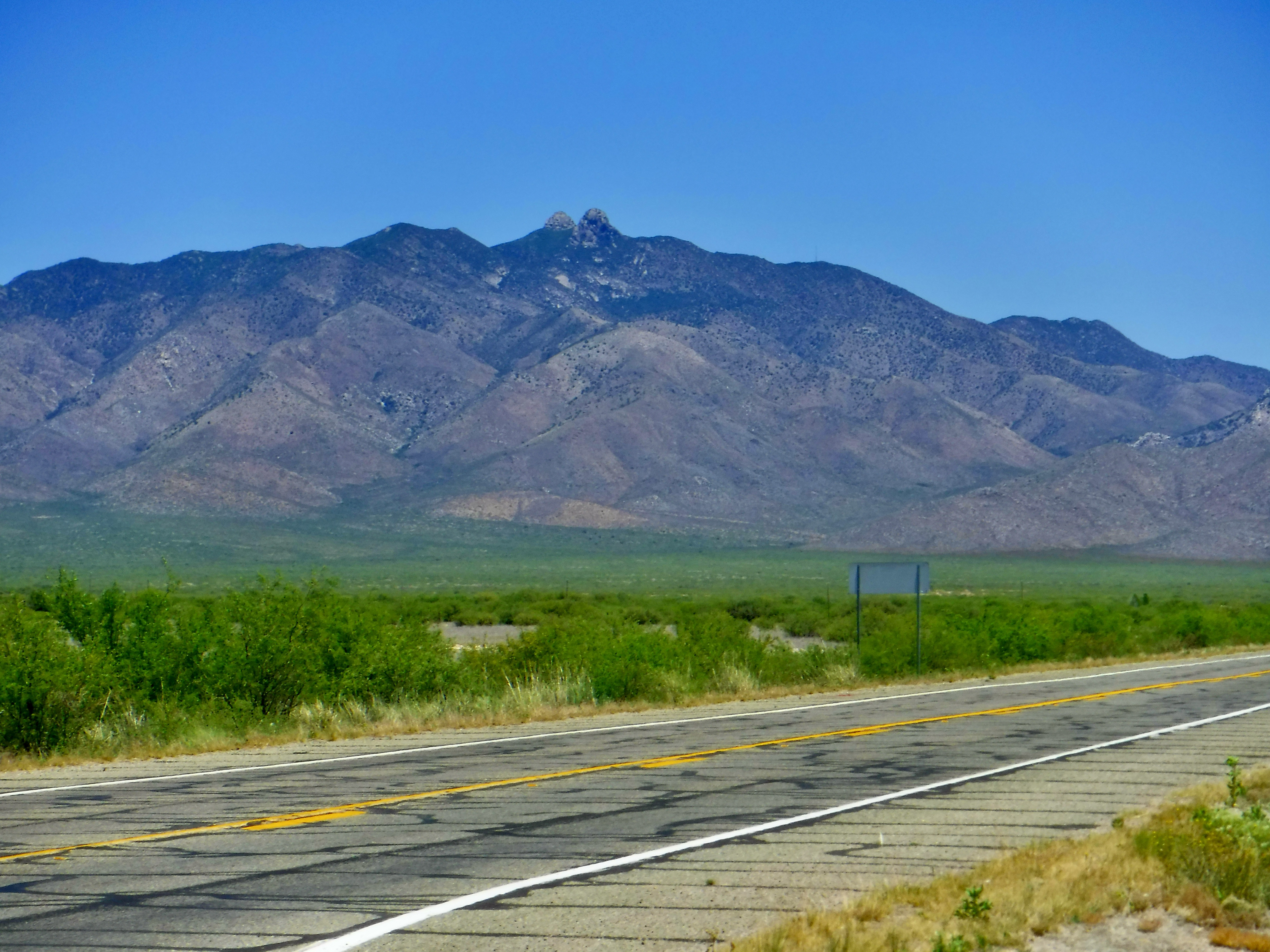 |
| The twin peaks of Dos Cabezas, an instantly recognizable landmark. |
Once the territory of Cochise's band of Chiricahua Apache, many of those interred in the Dos Cabezas Cemetery had lives shaped or ended by the Apache. William Maxwell Downing, known as "Major Downing" to locals, was the first white settler in the Chiricahua Mountains to the south. Born in Kentucky in 1825, he lived in the Chiricahuas until 1878, operating a lumber mill. Upon his death on March 3, 1898, the Arizona Republic noted that "The old timers and early residents of Cochise county are one by one being called to their home of rest where they will have no fear of the dreaded Apache as they have had." Downing was buried beside the daughter, Delia, who pre-deceased him. His wife, Ellen, later joined them.


Downing's lumber enterprise saw him supplying Tombstone with product, and in 1880 he shows up in the federal census as having an address on Allen Street with his wife and daughter. It's likely they stayed in town while he worked (and primarily resided at) the lumber camp, as was often the practice at the time. By the time of his death, however, his wife had relocated to Deming, NM, just across the territorial line. The 1882 BLM / Government Land Ordinance survey shows him homesteading 80 acres in the Chiricahuas near Pinery Creek and conveniently located by the road to Tombstone.
Downing's wife, Ellen, was originally Ellen C. Willard. It wasn't until the occasion of her husband's death that she was reunited with her brother after 41 years. He made the trek from Prescott down to Tombstone (at the time, the Cochise county seat) to help Ellen with probate matters two weeks after Major Downing's passing.
For fellow Arizona history buffs (and if you're reading this far, you must be one!), note that Major Downing is not the same William Downing who gained notoriety for robbing trains and other nefarious behavior, ultimately ending such activity at the hands of an Arizona Ranger.

Buried elsewhere in the Dos Cabezas Cemetery is pioneer William Vandewalker, a native of Oneida, New York. A farmer, Vandewalker was the father of two men who operated mining businesses in Dos Cabezas. He and his son, George, settled in Humboldt County, California, before moving to Arizona Territory; the senior Vandewalker operating a farm while George and family raised cattle. George became a prominent cattleman in Willcox, and operated the Bertha mill-site in Dos Cabezas. The other son, William, owned the Los Star Mine. The patriarch had moved to Dos Cabezas in 1882. By 1894, son George was running French Merino cross sheep in the St. Johns area well north of Cochise County, perhaps as their summer pasture. He also bought his "graded stock cattle" in St. Johns before moving them to his Dos Cabezas-area ranch in 1896.
Several members of Cochise County's prominent ranching family, the Klump clan, are buried in the Dos Cabezas Cemetery. Not only are the Klumps a significant part of the county's history, but they continue to keep it alive through their contributions to the Sulphur Springs Valley Historical Association and Museum. If you rely on Sulphur Springs Valley Electrical Co-Op for your power, as I do, you'll be familiar with Kathy Klump's excellent articles on local history in each issue of the Co-Op's member magazine.


Historical Atlas of Arizona I cannot survive without this outstanding collection of historical maps of the state. If you're a map nerd as I am, you will quickly tatter the pages of this book.
Copyright (c) 2024 by Marcy J. Miller * All rights reserved * No part of this content may be reproduced without the express permission of the author * Links to this page, however, may be freely shared and are appreciated * Thank you for sharing, linking, and otherwise helping grow my readership, but most of all, thank you for stopping by!
That’s so cool that you do this! I don’t live in Arizona, but I love reading about the history of the West. We think of Arizona as it is now, but even 100 years ago, it was still relatively wild in comparison to other states.
ReplyDelete